Marknadens största urval
Snabb leverans

Atlaser och kartor

Vår planet är enorm och består av ett stort antal länder, till och med öar som vi ännu inte har utforskat. På denna sida vill vi ta med dig på en resa genom jordens olika platser och vad de heter. Kunskapen om planeten är fantastisk och kan möjligtvis ge dig några häftiga idéer som du kan diskutera med dina nära och kära. Skapa din egen resa, eller lär dig mer om planeten och lär känna länder som du förmodligen inte har hört talas om förut. Förutom kunskap om världen och de många vägarna finns det mycket läsmaterial för det historiska hjärtat. Kartläggningen av atlas genom tiderna och hur världen har sett ut förut! Hitta inspirationen till din nästa resa här hos oss.
Visa mer
Filter
Filter
Sortera efterSortera Populära
  • av DK Eyewitness
    136,-

    An unbeatable, pocket-sized guide to Istanbul, packed with insider tips and ideas, colour maps and top 10 lists - all designed to help you see the very best of Istanbul.Spend time sailing down the Bosphorus, try your hand at haggling in the Grand Bazaar, visit the Blue Mosque or experience Istanbul's famous nightlife in Beyoglu. From Top 10 beaches to the Top 10 galleries and museums - discover the best of Istanbul with this easy-to-use travel guide.Inside Top 10 Istanbul:- Eight easy-to-follow itineraries, perfect for a day trip, a weekend or a week- Top 10 lists showcase Istanbul's best attractions, covering Topkapi Palace, the Blue Mosque, the Hagia Sophia, the Grand Bazaar and more.- In-depth neighbourhood guides explore Istanbul's most interesting areas, with the best places for shopping, going out and sightseeing - Colour-coded chapters divided by area make it easy to find information quickly and plan your day - Essential travel tips including our expert choices of where to stay, eat, shop and sightsee, plus useful transport, visa and health information- Colour maps help you navigate with ease- Covers the Old City, Beyoglu, Istiklal Caddesi and more.About DK Eyewitness Travel: DK's Top 10 guides take the work out of planning a short trip, with easy-to-read maps, tips and tours to inform and enrich your weekend trip or cultural break. DK is the world's leading illustrated reference publisher, producing beautifully designed books for adults and children in over 120 countries.

  • - From beans to brewing - coffees explored, explained and enjoyed
    av James Hoffmann
    350,-

    This ultimate guide to coffee contains comprehensive details on the beans and brews of more than 35 countries.

  • - (A3 Spiral binding)
    av Philip's Maps
    226,-

    Philip's: the UK's best-selling Europe Atlas range. All the maps you need for travelling in Europe plus key driving regulations for each country. Large A3 size with practical lie-flat spiral binding.

  • av Karen Macneil
    426,-

  • - A Field Guide to the Hidden World of Everyday Design
    av Roman Mars, Kurt Kohlstedt & 99% Invisible
    290,-

    An alternative guide to the hidden everyday objects in a city, from the hugely successful podcast 99% Invisible

  • av Lonely Planet
    290,-

    Looking for an eco-friendly and convenient way to explore Europe? This ultimate guide to train travel reveals how to make the most of the continent's high-speed services, sleeper trains and scenic routes. Packed with maps and insider tips, you'll discover everything from how to piece together your trip to ways to book the best value tickets.

  • av Collins Maps
    406,-

    Fully revised general reference atlas in the exciting Collins World Atlas range. Highly detailed maps giving balanced worldwide coverage, beautifully illustrated thematic pages and thousands of facts and statistics, including world and continental ranking tables.

  • - (A4 Spiral binding)
    av Philip's Maps
    150,-

    A new edition of this detailed road atlas of Scotland - part of a series of Navigator regional atlases featuring Philip's exceptionally large-scale and detailed Navigator maps in an easy-to-handle format.

  • av Dave Broom
    496,-

    This new, fully updated edition of The World Atlas of Whisky provides an in-depth, comprehensive journey through the history, process, distilleries and expressions of world whiskies.

  • av Lonely Planet
    220,-

  • - 14th Edition
    av Times Atlases
    2 126,-

    The latest edition of the world's most prestigious and authoritative world atlas, containing up-to-date world maps and thematic information curated by experts in geography and cartography.

  • - (A4 Spiral binding)
    av Philip's Maps
    210,-

    Philip's: the UK's best-selling European Atlas range. Perfect for driving in Europe, and including all the key driving regulations for each country, this Road Atlas is a practical A4 size with lie-flat spiral binding. A new additon to Philip's Easy to Read Road Atlas range.

  • - Fifty Islands I Have Not Visited and Never Will
    av Judith Schalansky
    296,-

    An atlas that takes us across the oceans of the world to fifty remote islands. It features rare animals and lost explorers, marooned slaves and lonely scientists, mutinous sailors and forgotten castaways.

  • av Times Atlases
    976,-

    A fully revised and updated twelfth edition of this major world atlas in the authoritative and prestigious Times Atlas range. This beautifully designed atlas has all the information you need, whether planning a trip, keeping in touch with world news, solving quizzes and crosswords or just exploring the world from your armchair.

  • av Lonely Planet
    105,-

    Durable and waterproof, with a handy slipcase and an easy-fold format, Lonely Planet Europe Planning Map is your conveniently-sized passport to traveling with ease. With this easy-to-use, full colour navigation tool in your back pocket, you can truly get to the heart of the Europe, so begin your journey now!

  • av National Geographic
    886,-

    Uniting National Geographic's incomparable photography with state-of-the-art cartographic technology, this is the most compelling, authoritative, and up-to-the-moment visual atlas on the market.

  • av DK Eyewitness
    170 - 190,-

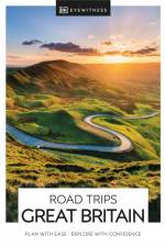
    With its idyllic market towns, romantic castle ruins and stunning natural landscapes, Great Britain is the perfect destination for a leisurely road trip. It's yours to explore with Road Trips Great Britain, which contains 25 drives across the country, from the sweeping sandy beaches of Cornwall to the dramatic peaks of the Scottish Highlands.Includes insider tips and information, this easy-to-use e-guide reveals Great Britain at its best: spectacular sights, hidden gems and authentic local experiences. We've also worked hard to make sure our information is as up-to-date as possible following the COVID-19 outbreak.You'll discover:- 25 easy-to-follow driving tours, each lasting one to five days, including sleepy Cotswold villages, the majestic unspoiled waters of the Lake District and scenic Brecon Beacons National Park- Ideas for discovering the character of each area en route: great views, delightful detours along peaceful back roads, walks through historic towns and villages, wine tours and boat trips, and activities such as hiking, cycling and kayaking. Plus you'll savour the best local experiences with our pick of the most authentic places to stay, eat and shop- All the British rules of the road, postcodes for use with satnav and detailed directions for easy navigation, information on road conditions and parking tips- Covers Cornwall, Devon, the Jurassic Coast, Salisbury, Bath, Glastonbury, the Cotswolds, the Chilterns, the South Downs, Brighton, Kent, Cambridgeshire, Norfolk, the Brecon Beacons, West Wales, Snowdonia, Offa's Dyke, the Peak District, Yorkshire, the Lake District, Northumbria, Edinburgh, Fife, the Scottish Highlands, the Scottish Lochs, Aberdeen, Inverness, and moreLooking for even more inspiration for your trip to Great Britain? Try our DK Eyewitness Great Britain.

  •  
    220,-

    Für alle, die sich bequem informieren möchten, ist der Michelin Straßenatlas Europa mit der hervorragenden Kartographie die ideale Lösung!- Die Michelin Straßenatlanten sind der perfekte Reisebegleiter: Beispielhaftes Kartenbild und höchste Präzision für jeden Autofahrer, auf Urlaubsreisen oder im beruflichen Alltag- Michelin Kartografie: aktuell und sehr gut lesbar- Schneller und einfacher Zugriff: Die Übersichtskarte verweist auf die richtigen Seiten, das ausführliche Inhalts- und Ortsverzeichnis ermöglicht eine leichte Orientierung- Maßstab: 1:500.000-1:3.000.000

  • av David Brawn
    160,-

    For the best adventures, use the best map. This updated 4th edition is a collection of four 30k scale map sections on a double sided sheet of 840mm by 600mm which folds up to 220mm by 120mm. Highly detailed maps cover Valle de Orotava, West, Anaga and Adeje/Arona - Teide. Printed on waterproof, tearproof recyclable material.

  • av Freytag & Berndt
    316,-

    Der Straßenatlas Deutschland 1:200.000, 2024/2025 ist der ideale Begleiter für alle, die in Deutschland mit dem Auto unterwegs sind und dabei nicht nur die Autobahn nutzen möchten. Er ist ideal für die Planung und erweist sich auch während der Reise als unverzichtbare Orientierungshilfe.Mit dem detailreichen Kartenbild und dem genauen Maßstab lassen sich auch weniger befahrene Nebenstraßen entdecken, die in Übersichtskarten meist gar nicht eingezeichnet sind. Landschaftlich schöne Strecken sind farblich hervorgehoben. Im Kapitel "Traumrouten" werden 50 der schönsten Routen Deutschlands auf 20 Seiten beschrieben.Informationen zum Straßenatlas Deutschland 2024/2025Deutschland 1:200.000Alpenbogen 1:500.000Europa 1:3,5 Mio.Spiralbindung verdeckt50 Themen- und FerienstraßenCamping- und StellplätzeReduzierter Index (Gesamter Index online abrufbar)312 Seiten, Format 23 x 29,7cmDer beste Autoatlas für Deutschland Das dichte Straßennetz ist exakt abgebildet, landschaftlich schöne Strecken und Touristenstraßen sind farblich hervorgehoben und viele Ausflugsziele sind in der Karte eingezeichnet. Auto- und Motorradfahrer schätzen die exakte Kartographie von freytag & berndt besonders für die Planung und Orientierung vor Ort. Damit die Reise auch mit Wohnmobil, Wohnwagen oder Camper gut planbar ist, sind alle Camping- und Stellplätze im Atlas eingezeichnet. 50 Traumrouten "Raus aus dem Alltag, entschleunigen und die Landschaft genießen" lautete die Devise bei der Auswahl der 50 beschriebenen Themen- und Ferienstraßen. Sie verteilen sich über ganz Deutschland und spiegeln mit ihren unterschiedlichen thematischen Schwerpunkten die Vielfalt der Bundesrepublik wider.

  • av Karen Macneil
    550,-

    Discusses the history of wine, grape varieties, wine-making techniques, vintages, and more.

  • - The 350 Most Beautiful Cycling Routes in Europe
    av Claude Droussent
    370,-

    Featuring lovely scenery and dramatic panoramas, these carefully selected tours of the most beautiful places to pedal throughout Europe are for both seasoned and novice cyclists and feature the groundbreaking user-sourced mapping technology of the Strava app.

  • av DK Eyewitness
    200 - 256,-

    DK Eyewitness travel guides: award-winning guidebooksDiscover France with this essential travel guide, designed to help you create your own unique trip and to transport you to this beautiful country before you've even packed your case - wander the world-class museums of Paris, step back in time at Versailles, relax on the stunning beaches of Provence or experience the spectacular beauty of the Alps. The DK Eyewitness Guide France covers the must-see sights and the hidden backstreets, so you won't miss a thing.- Gorgeous, all-new colour photography so you can imagine yourself there- Reasons to love France: incredible architecture, world-famous vineyards, chic beach resorts - what will yours be?- See France from a different angle - over 30 pages of fresh ideas for exploring this spectacular country- A year-long calendar of events gives a selection of celebrations and festivals for all seasons- Expert advice covers the practical stuff: get ready, get around and stay safe- Detailed colour maps help you navigate the country with ease- Expert tips to make memories that last - where to snap and share the perfect photo, take in stunning views and escape the crowds- The most authentic places to stay, eat, drink and shop- Easy-to-follow walks and itineraries cover the whole country, with plenty of eat and drink stops en route- Hand-drawn illustrations show the inside of the must-see attractions, including the Mus e du Louvre, Notre-Dame, Chartres Cathedral and the Ch teau de Chambord.- Covers Ile de la Cit , Marais and Beaubourg; Tuileries and Op ra; Champs-Elys es and Invalides; The Left Bank; Beyond the City Centre; Le Nord and Picardy; Champagne; Alsace and Lorraine; Normandy; Brittany; The Loire Valley; Burgundy and Franche-Comt ; The Massif Central; The Rh ne Valley and French Alps; Poitou and Acquitaine; P rigord, Quercy and Gascony; The Pyrenees; Languedoc-Roussillon; Provence and the C te d'Azur; and Corsica. DK Eyewitness Travel Guide France is a detailed, easy-to-use guide designed to help you create your own unique trip.Travelling with kids? Try our DK Eyewitness Family Guide France.About DK Eyewitness Travel: For 25 years, DK's beautifully practical Eyewitness guides have been combining inspiring ideas and expert advice with easy-to-read maps and vivid photography to inform and enrich your holiday. This year they have been given a stunning new look that you will love even more. DK is the world's leading illustrated reference publisher, producing beautifully designed books for adults and children in over 120 countries.

  • av Clemence Polge
    350,-

    A travel guide for adventurous people who want to experience Norway from the freedom of a camper van. Full of useful camping tips, routes and vanlife addresses.

  • av Lonely Planet
    510,-

    Combining our extensive mapping experience and unrivalled destination knowledge, our first dedicated atlas is packed with insightful commentary and inspiring images to help you explore the world and plan trips with ease. Each large page of mapping is accompanied with top sights and activities, while popular regions are presented at greater scale.

  • av Henry Stedman
    180,-

    All-in-one, two-directional, hiking route guide, maps and accommodations for the popular Hadrian's Wall Path long-distance trail that follows the old Roman wall for 84 miles (135km) across the north of England.Includes 59 large-scale maps (3 1/8 inches to 1 mile); 8 town plans and 6 overview maps. Full details of all accommodations and campsites, restaurants and pubs; plus full public transport information. Includes day-walks.

  •  
    216,-

    Whichever city you choose - though we recommend all three, of course - you'll be charmed like a snake on Jemaa El Fna in no time. And to help you sift through the noise, here's our rundown of the best that Morocco has to offer. Marhaba!Morocco may be a short hop, skip and a jump across the Med from Europe but it feels like another world. Salesmen flaunting their wares in the souks, robed figures rushing to prayer and ancient palaces decked with dazzling tiles - it's easy to fall under its spell.Marrakech, on the cusp of both desert and mountain, offers old-world glamour and an enthralling sense of adventure. Casablanca, lapped by the Atlantic, is a thoroughly modern metropolis with a special affinity for art deco. And at the northernmost tip of the country is the eccentric cliffside city of Tangier, where many a writer and artist have pitched up and sought inspiration over the years.

  • av David Brawn
    160,-

    La Gomera and El Hierro Tour & Trail Maps are the most detailed, accurate, toughest, easy to read, large scale maps of La Gomera and El Hierro that you can buy. Digital editions of Tour & Trail Maps for phone apps and Garmin users are available on the dwgwalking website.

Gör som tusentals andra bokälskare

Prenumerera på vårt nyhetsbrev för att få fantastiska erbjudanden och inspiration för din nästa läsning.