Marknadens största urval
Snabb leverans

Atlaser och kartor

Vår planet är enorm och består av ett stort antal länder, till och med öar som vi ännu inte har utforskat. På denna sida vill vi ta med dig på en resa genom jordens olika platser och vad de heter. Kunskapen om planeten är fantastisk och kan möjligtvis ge dig några häftiga idéer som du kan diskutera med dina nära och kära. Skapa din egen resa, eller lär dig mer om planeten och lär känna länder som du förmodligen inte har hört talas om förut. Förutom kunskap om världen och de många vägarna finns det mycket läsmaterial för det historiska hjärtat. Kartläggningen av atlas genom tiderna och hur världen har sett ut förut! Hitta inspirationen till din nästa resa här hos oss.
Visa mer
Filter
Filter
Sortera efterSortera Populära
  • av Berndt & Freytag
    407

    Der Straßenatlas Norwegen 1:250.000 - 1:400.000 ist der ideale Begleiter für alle, die in Norwegen mit dem Auto unterwegs sind und dabei nicht nur die Hauptstraßen nutzen möchten. Er ist ideal für die Planung und erweist sich auch während der Reise als unverzichtbare Orientierungshilfe. Mit dem detailreichen Kartenbild und dem genauen Maßstab lassen sich auch weniger befahrene Nebenstraßen entdecken, die in Übersichtskarten meist gar nicht eingezeichnet sind. Landschaftlich schöne Strecken sind farblich hervorgehoben. Informationen zum Straßenatlas Norwegen Norwegen 1:250.000 - 1:400.000 Spiralbindung verdeckt Camping- und Stellplätze Touristische Informationen Ortsregister mit Postleitzahlen Format 23 x 29,7 cm Der beste Autoatlas für Norwegen Das dichte Straßennetz Norwegens ist exakt abgebildet, landschaftlich schöne Abschnitte und Touristenstraßen sind farblich hervorgehoben und viele Ausflugsziele sind in der Karte eingezeichnet. Auto- und Motorradfahrer schätzen die exakte Kartographie von freytag & berndt besonders für die Planung und Orientierung vor Ort. Damit die Reise auch mit Wohnmobil, Wohnwagen oder Camper gut planbar ist, sind alle Camping- und Stellplätze im Atlas eingezeichnet. Verdeckte Spiralbindung Der Autoatlas Norwegen ist besonders komfortabel in der Handhabung da er sich durch die Spiralbindung bequem aufklappen lässt. Auch während der Fahrt bleibt die gewünschte Seite so geöffnet. Innenstadtpläne Mit den enthaltenen Cityplänen kann man sich in diesen Städten gut orientieren: Bodø, Bergen, Hammerfest, Kristiansand, Narvik, Stavanger, Oslo, Trondheim. Gedruckt in Österreich

  • av Nikki Page
    411

    Ready to turn your travel dreams into reality? Whether you're a first-time traveler or looking to enhance your globetrotting experiences, the #1 bestselling book by travel author Nikki Page, Let's Travel the World, is your ultimate guide to embarking on unforgettable adventures across the glo

  • av Lauren Yoshiko
    247

    The first ever guide to ethically-operated legal cannabis destinations across the US.

  • av Steve Wide
    201

    Hidden Pockets in Kyotois your guide to losing yourself in this Japanese city that seamlessly intertwines modern and traditional influences. Whether you’re satisfying your tastebuds in contemporary cafes, wandering among the untarnished architecture of Gion or heading back in time while visiting ancient temples and shrines, Kyoto is a captivating city to explore.   Curated by authors Steve Wide and Michelle Mackintosh, who consider Japan their ‘home away from home’, this travel guide navigates the country’s cultural capital like a local, with chapters for kissatens (coffee shops), gardens, temples, omiyage (local products), mindful experiences and places to enjoy delectable sweets. Build your day with a variety of half-day and full-day itineraries and bask in Kyoto’s seasonal beauty as you explore lantern-lit alleys that reveal the city’s unique precincts, and uncover hidden artisanal treasures and flavors that will challenge and delight your senses. Venture beyond the metropolis to unearth the heart of the city with this Curious Travel Guide.

  • av Travis Elborough
    151

    In 45 unique maps and with evocative photography, Atlas of Unexpected Places is a journey to far-off lands, obscure discoveries and unimaginable locations.

  • av Clark C Reynolds
    177

  • av Yoshiki Wakabayashi
    1 647 - 1 651

    Since the last decades of the twentieth century, the circumstances surrounding map use and map making have drastically changed owing to advances in information and communication technologies (ICTs). In particular, the spread of web maps and mobile devices have altered the way people interact with maps. This book features the latest works on theoretical and practical issues of these changes by terming them "e;ubiquitous mapping"e;. In particular, the book pays attention to not only the technological basis but also multidisciplinary human-social aspects. The book covers the topics of the evaluation of ICT-based technologies for context-aware mapping, the theory and application of crowd-sourced geospatial information and collaborative mapping, and both the positive and negative effects of ubiquitous mapping on human society.

  • av Neal Asbury
    371

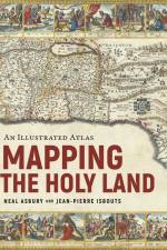
    A stunning journey through the Holy Land, as told by the rare maps and prints that have long inspired Jewish, Christian, and Muslim pilgrimages. From the earliest days of the Roman Empire to the current war between Israel and Hamas, mapping the Holy Land has been a never-ending source of high aspirations and bitter conflict. Sacred to Jews, Christians, and Muslims, the Holy Land has always inspired Christians to walk in the footsteps of the Bible, to imagine the route of the Exodus, or discover the places of Jesus' ministry. Muslims, too, longed to see the geographical contours of the ummah, the greater Muslim community, while Jews remembered the days when Jerusalem was the destination for three holy festivals. In response, cartographers from Late Antiquity to the Modern Age drew their inspiration from Jewish, Christian, and Muslim pilgrimages to depict, with growing confidence, the exotic locations of the Holy Land. Mapping the Holy Land is the first book to tell the thrilling story of these travels and the incredible prints and maps they spawned, up to the wars of the twentieth and twenty-first centuries. Illustrated with rare, hand-colored maps and engravings throughout and riveting scene-setting history, this remarkable volume from rare maps collector Neal Asbury, CEO of The Legacy Companies and host of Neal Asbury's Made in America, and National Geographic best-selling author Jean-Pierre Isbouts, coauthors of Mapping America, shows how the faithful overcame impossible odds to reach the Holy Land, and dives deep into the historical understanding of these elusive lands from Roman times up to the modern Israeli-Arab conflict.

  • av Times Atlases
    337

    An excellent world atlas for everyday use at home or work, representing broad coverage at a great price. Clear, authoritative Times atlas mapping fully updated.

  • av A-Z Maps
    137

  • av A-Z Maps
    147

    The A-Z Adventure Series of maps is the perfect companion for walkers, off-road cyclists, and anyone wishing to explore the great outdoors.

  • av Stefan Bachmann
    347

    "A spellbinding tour, filled with stories and photographs, of some of the world s most fascinating architectural mysteries."--

  • av ITM Publications
    161

    ITMB is pleased to introduce this new map, using our own artwork, for Madrid, covering essentially all the area within the circular ring road motorway. All the streets are named and included in a place names index. Parks, touristic attractions, hotels, shopping areas, churches, mosques, restaurants, pubs, transit lines – it’s all there. Coverage is from the railway station in the south to the university in the north and from the Parque del Oeste in the west to the bull fighting ring in the east. The reverse side is a detailed regional map for the Castilla La Mancha province to the south of Madrid, with Toledo, Albacete, Murcia, and Cordoba. All roads and parks are shown, as well as major touristic attractions.

  • av Michelin
    106

    Falset kort i målestokken 1:500.000 over staterne New York, Vermont, New Hampshire, Massachusetts, Connecticut, Rhode Islands samt dele af Ontario, Maine New Jersey samt Pennsylvania. Med register påtrykt bagsiden.

  • Spara 13%
    av Jon Waterman
    667

    From the deep forests of the Canadian Northwest to the red-rock deserts of the American Southwest, North America offers a myriad of opportunities for hiking, camping, trekking, and simply enjoying the abundance of the natural world. This opulent volume highlights 41 of those wilderness locations.Filled with authoritative maps, data-driven graphics, awe-inspiring photographs, and thoughtful essays, this vivid book will feed the soul of everyone who loves wild places. Six lush chapters take readers from the eastern woodlands to the central plains, from the northern wilderness to southwestern desert lands—including key wilderness areas in Canada and Mexico. You’ll discover the fascinating history of the High Peaks of the Adirondacks, learn about fossil remains on the Upper Missouri River, gaze through the rainforest canopy of Alaska’s Tongass National Forest, and experience Grand Canyon Parashat’s Dark Sky Park. A special section rich in maps and graphics highlights 13 thematic topics, such as the National Scenic Trail System and the human impact on wilderness areas.This beautiful book, bursting with information and lyricism, will inspire all who have journeyed into the wild—and intrigue many who still hope to do so.

  • av Alasdair C. Whyte
    171

    A fascinating study by three experts which uncovers - contrary to received opinion - that Glasgow's Gaelic roots run deep and are a fundamental component of its identity. Includes an A-Z list of modern place-names and their Gaelic origins.

  • av Philip's Maps
    261

    The only county Street Atlas with all the named streets of Devon and perfect back-up for emergency services, delivery drivers, visitors and locals.

  • av Philip's Maps
    261

    Philip's created this new series for walkers, cyclists and local explorers at a scale that provides greener options to uncover all the nature and hidden gems in your local area. From Barnstaple to Totnes, we cover Devon in enticing detail.

  • av Philip's Maps
    247

    Philip's created this new series for walkers, cyclists and local explorers at a scale that provides greener options to uncover all the nature and hidden gems in your local area. From Beccles to Wymondham, we cover Norfolk in enticing detail.

  • av Philip's Maps
    247

    The only county Street Atlas with all the named streets of Norfolk and perfect back-up for emergency services, delivery drivers, visitors and locals.

  • av Sk. Mustak
    2 501

    This book introduces the use of various remote sensing data such as microwave, hyperspectral and very high-resolution (VHR) satellite imagery; mapping techniques including pixel and object-based machine learning; and geostatistical modelling techniques including cellular automation, entropy and land fragmentation. Remote sensing plays a vital role in solving urban and environmental challenges at the landscape level. Globally, more than half of the urban population is facing severe environmental and social challenges, especially those relating to climate change, agricultural land encroachment, green infrastructure and environmental degradation, mobility due to rapid rural¿urban transformation and anthropogenic interventions. Mapping and quantification of such threats at the landscape level are challenging for experts using traditional techniques; however, remote sensing technology provides diverse spatial data at a varying scale, volume and accessibility for mapping and modelling, and it also analyses challenges at urban and landscape levels.Together, they address challenges at urban and landscape levels to support the Sustainable Development Goals (SDGs).

  •  
    257

    Perfect for professional drivers to use whilst on the road and when planning routes, this large format A3 atlas has a clear 3 miles to 1 inch scale and included over 3,600 bridge height restrictions clearly located, 23 port plans and clear route planner map and Network Rail's #wiseupsizeup campaign with information on how to prevent bridge strikes.

  • av Jacobo García-Álvarez
    1 527 - 1 637

    This book brings together ten empirically rich and theoretically informed contributions that aim to clarify both geo-historical specificities and common transnational and global features of the cultures and practices of boundary making that shaped modern statehood. Written by scholars from Spain, France, Italy, Argentina, Brazil and Mexico, the essays included in this volume provide a comparative international perspective on the processes of border formation, as well as an integrative approach that seeks to strengthen the links between renewed geo-historical studies and more contemporary-oriented border studies. The book is addressed to a wide range of researchers, including geographers, historians, political scientists and specialists in geopolitics and the history of international relations.

  • av Christopher Jekeli
    2 611

    This book covers all aspects of inertial navigation systems (INS), including the sensor technology and the estimation of instrument errors, as well as their integration with Global Navigation Satellite Systems, specifically the Global Positioning System (GPS) for geodetic applications. The text is of interest to geodesists, including surveyors, mappers, and photogrammetrists; to engineers in aviation, navigation, guidance, transportation, and robotics; and to scientists involved in aerogeophysics and remote sensing. The most recent developments are covered with this second edition that also features an updated treatment of the classical material. Detailed mathematical derivations of the principles of measurement and data processing of inertial measurement units for both stabilized and strapdown systems. Complete treatment of the error dynamics from a statistical viewpoint, including the Kalman filter. A self-contained description of GPS with emphasis on kinematic applications. Key concepts supported by illustrations and numerical examples.

  • av A-Z Maps
    281

    Navigate your way around Great Britain with this detailed and easy-to-use A-Z Road Atlas

  • av National Trust Books
    191

    A full-size folding map with every National Trust and National Trust for Scotland place markedPacked with practical information and quirky triviaBeautiful illustrationsFeatures the `National Trust 80¿, a dream route around the UK

  • av A-Z Maps
    191

    Navigate your way around Great Britain with this detailed and easy-to-use A-Z Road Atlas

Gör som tusentals andra bokälskare

Prenumerera på vårt nyhetsbrev för att få fantastiska erbjudanden och inspiration för din nästa läsning.