Marknadens största urval
Snabb leverans

Atlaser och kartor

Vår planet är enorm och består av ett stort antal länder, till och med öar som vi ännu inte har utforskat. På denna sida vill vi ta med dig på en resa genom jordens olika platser och vad de heter. Kunskapen om planeten är fantastisk och kan möjligtvis ge dig några häftiga idéer som du kan diskutera med dina nära och kära. Skapa din egen resa, eller lär dig mer om planeten och lär känna länder som du förmodligen inte har hört talas om förut. Förutom kunskap om världen och de många vägarna finns det mycket läsmaterial för det historiska hjärtat. Kartläggningen av atlas genom tiderna och hur världen har sett ut förut! Hitta inspirationen till din nästa resa här hos oss.
Visa mer
Filter
Filter
Sortera efterSortera Populära
  •  
    12 847

    This renowned reference title provides up-to-date impartial commentary on political and economic developments in the region, alongside extensive and updated statistical and directory information.

  •  
    119

    Folding street map of Aberdeen. Updated to show all the recent developments

  • - Limerick, Tipperary, Waterford
     
    164

    The Discovery Series are designed for tourist and leisure activities. Each one covers an area of 40km x 30km at the scale of 1:50,000. There are 93 sheets in the series. 75 are produced by Ordnance Survey Ireland and 18 by Ordnance Survey Northern Ireland. The maps produced by Ordnance Survey Northern Ireland are called the Discoverer Series.

  • av Roger Lascelles
    151

  • - Second Edition
    av Brian Mitchell
    467

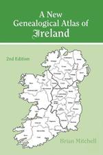
    "Since its publication in 1986, A New Genealogical Atlas of Ireland has established itself as a key resource in Irish genealogical research. Now, with the addition of maps detailing the location of Roman Catholic parishes in all thirty-two counties of Ireland and Presbyterian congregations in the nine counties of Northern Ireland, this new 2nd Edition moves the book to the forefront of Irish genealogical research. Also, for the first time ever, this one volume contains a complete geographical picture of the three major religious denominations in Ireland during the middle years of the 19th century.And just what is the importance of this? Civil registration for everyone in Ireland didn't begin until 1864. Prior to that, the only records of births, marriages, and deaths were found in local parishes. Therefore, the first step in any Irish research for the first half of the 19th century and before should be to identify the religious denomination and parish of your ancestor. Although any of the Townland Indexes from 1851, 1871, or 1901 will show the location of each civil parish (which generally corresponds to the boundaries of the Church of Ireland parishes), it has been much more difficult to uncover the corresponding Catholic parish or Presbyterian congregation. Until now!This new 2nd Edition is not only invaluable for tracing your pre-1864 ancestors in church records but also for locating your post-1864 ancestor in civil records, for this volume provides descriptions and maps of the parochial and civil administrative divisions to which all major Irish record sources are linked. To aid the researcher in identifying the precise location of the administrative divisions, and thus their jurisdiction, Mr. Mitchell has drawn at least four, and sometimes five, maps for every county. The first county map depicts the civil/Church of Ireland parishes; the second shows the baronies and Church of Ireland dioceses; the third map illustrates the poor law unions and the parishes included within the probate districts serving that county; the fourth plots Roman Catholic parishes and dioceses; and the fifth locates Presbyterian congregations for the nine counties of Northern Ireland. Three maps of Ireland are also included to show the area covered by each county, diocese, and probate district. In addition, the book describes all of the major record sources of Ireland.These maps provide the clues to the Irish origins of millions of Americans, making this atlas indispensable for tracing ancestors in Ireland!"

  • - Can you solve over 350 clues on a puzzle adventure from your own home?
    av Ordnance Survey
    197

    Solve the clues and find the treasure in this puzzle adventure from the phenomenal bestselling Ordnance Survey Puzzle Books.

  • av Carol Foreman
    211

    In this hugely enlightening book, Carol Foreman investigates the origins of many of Glasgow's street names, examining the influences and inspirations for many of the city's most famous thoroughfares, from local association and sentimentality to the influence of royalty, distinguished individuals and historical events.

  • - Michelin City Plans
    av Michelin
    101

    Discover Saint Petersburg by foot, car or bike using Michelin Saint Petersburg City Plan (scale 1/12,500 cm). In addition to Michelin's clear and accurate mapping, this city plan will help you explore and navigate across Saint Petersburg different districts thanks to its full index, its comprehensive key showing places of interest and tourist attractions, as well as practical information on public transport leisure facilities, service stations and shops!Discover the new range of Michelin City Maps* Write on Wipe off ,Draw your route with a felt tipped pen, Erase with a damp cloth!* Plastic Format* Durable and convenient to use* Handy Compact, folds "free" for easy handling* Clarity and legibility of Michelin mapping:* Map of the city centre with identified tourist sites* Green Guide tourist sites* Smaller Map of whole city* Underground Map, with a detailed index

  • - Sahaptian Place Names Atlas of the Cayuse, Umatilla, and Walla Walla
    av Eugene S. Hunn
    357

    Draws from the knowledge of Native and non-Native elders and scholars to present an account of interactions between a homeland and its people. This title also presents descriptions of 400 place names. It paints a picture of a way of life that provides context for interpreting pre-contact communities.

  • - A Myanmar Heritage Trust Guide Map
    av Silkworm Books Ltd / Author
    175

    This first-of-its-kind city map will guide you as you explore these sights, taking you down alleyways, tree-lined promenades, and major thoroughfares to uncover the historical and architectural significance of Yangon's breathtaking landmarks.

  • - 20 of the Best Routes Chosen and Written by National Park Rangers
    av National Parks UK
    111

    The perfect companions for exploring the National Parks. Walking guide to the Lake District National Park, with 20 best routes chosen by the park rangers. Each walk varies in length from 2 to 10 km and can be completed in less than 4 hours.

  • - 20 of the Best Routes Chosen and Written by National Park Rangers
    av National Parks UK
    111

    Walking guide to the Snowdonia National Park, with 20 best routes chosen by the park rangers. Each walk varies in length from 2 to 10 km and can be completed in less than 4 hours.

  • - 20 of the Best Routes Chosen and Written by National Park Rangers
    av National Parks UK
    111

    The perfect companions for exploring the National Parks. Walking guide to the Peak District National Park, with 20 best routes chosen by the park rangers. Each walk varies in length from 2 to 10 km and can be completed in less than 4 hours.

  • - 1:25,000 scale Ordnance Survey mapping for the Wales Coast Path
     
    157

    One of seven handy, lightweight, pocket sized map bookscovering the whole of the 870 mile/1400 kilometre Wales Coast Path. This volume covers North Wales from Chester to Bangor and includes enhanced large scale (1:25,000) Ordnance Survey mapping in a handy atlas format.

  • Spara 15%
    av Ordnance Survey
    161

  • av Ordnance Survey
    201

  • av John Keay
    147

    A vivid description of one of the most ambitious scientific projects undertaken in the 19th century, and the men who undertook the measurement of the Himalayas and the mapping of the Indian subcontinent: William Lambton and George Everest.The graphic story of the measurement of a meridian, or longitudinal, arc extending from the tip of the Indian subcontinent to the mountains of the Himalayas.Much the longest such measurement hitherto made, it posed horrendous technical difficulties, made impossible physical demands on the survey parties (jungle, tigers, mountains etc.), and took over 50 years. But the scientific results were commensurate, including the discovery of the world's highest peaks and a new calculation of the curvature of the earth's surface.The Indian Mutiny of 1857 triggered a massive construction of roads, railways, telegraph lines and canals throughout India: all depended heavily on the accuracy of the maps which the Great Arc had made possible.

  • - Travel Journal Trip Organizer Vacation Planner for 4 trips with extensive checklists and more
    av A Verma
    157

  •  
    12 871

    Europäs comprehensive survey of the countries and territories of the region, providing expert analysis and commentary and containing up-to-date economic, socio-political and directory material.

  • - 2017 edition
    av Sandra Pisano
    117

  • av Sandy Nestor
    1 111

    The American Indians have lost much of their land over the years, but their legacy is evident in the many places around the United States that have Indian names. Countless placenames have, however, been corrupted over time, and numerous placenames have similar spellings but different meanings because of the way they were interpreted by various authorities.

  • - En pilgrimsvandring fra Djursland til Santiago de Compostela
    av Børge Jakobsen & Rie Pedersen
    497

    " - Tænk at være faret vild, ikke at kunne genkende noget som helst, mindre end ti kilometer fra mit hjem! Hvordan skal jeg overhovedet få vandret de resterende 3500 kilometer, der ligger foran mig?" Så drastisk begynder vandringen for Børge Jakobsen, én af de tusind danskere der hvert år drager på pilgrimstur. Men han har valgt at tage apostlenes heste hele vejen fra Djursland til Santiago de Compostella i Spanien. Som mange andre har han en drøm om frihed og fordybelse: at komme væk fra hverdagens stress, finde ind til de dybere lag i sig selv og få en inderligere kontakt med det spirituelle. Bogen skildrer udlevelsen af denne drøm: Pilgrimsturens op- og nedture, og hvad der sker med sindet under så lang en vandring.

  • - Your Step By Step Guide To Backpacking
    av Howexpert
    541

    If you want to discover how to backpack from a real life backpacker, then get the "How To Backpack" guide now.In this step-by-step guide, you will find out tips and lessons about backpacking the right way. How to plan backpacking trips. Find out what to do before the backpacking trip. How to get visa, papers, and insurance the affordable way. How to prepare for backpacking. How to sleep, eat, and have fun while backpacking. How to manage your money for backpacking. How to travel alone safe. Basic survival guide tips. Know exactly what to do when you arrive in a new place. Special backpacking tips and tricks.HowExpert publishes quick 'how to' guides on all topics from A to Z by everyday experts.

  • - Finding the Next Chapter
    av Billy Bob Brown
    197

    Have you completely figured out your life? If not, you're in good company. Journey and Struggle is a collection of stories detailing Billy Bob Brown's journey to meaning and purpose in his own life. He puts words to his inner restlessness and desire to chart a new career course to help solve the world's deepest needs. As you consider your own journey, realize it is not about the destination but about working your way through life lessons, burning away the bits and pieces, and discovering what truly matters to you. This book details ways to find the excitement and identify your life's purpose. Own who you are, and then step boldly into expressing your unique talents. In this book, you'll learn to: Inspire yourself Inspire a team Find hope for a generation And more! Journey and Struggle speaks to those who want to take action and make a difference. Young people will learn that even older people don't have it all together. And mature people will learn that in view of the infinite, life is just beginning!

  • - Getting Started, Breaking Through, Finishing Well
    av Jay E Adams
    347

  • - The Places that Shaped the Great Charter
    av Derek J. Taylor
    201

    The only book to tell Magna Carta's story through places associated with it, through England and France to the USA

  • - Discovering the Earth's Extraordinary Hidden Depths
    av Chris Fitch
    337

    A lavish, gorgeously-illustrated look at the strange worlds below the surface of our planet

Gör som tusentals andra bokälskare

Prenumerera på vårt nyhetsbrev för att få fantastiska erbjudanden och inspiration för din nästa läsning.