Marknadens största urval
Snabb leverans

Atlaser och kartor

Vår planet är enorm och består av ett stort antal länder, till och med öar som vi ännu inte har utforskat. På denna sida vill vi ta med dig på en resa genom jordens olika platser och vad de heter. Kunskapen om planeten är fantastisk och kan möjligtvis ge dig några häftiga idéer som du kan diskutera med dina nära och kära. Skapa din egen resa, eller lär dig mer om planeten och lär känna länder som du förmodligen inte har hört talas om förut. Förutom kunskap om världen och de många vägarna finns det mycket läsmaterial för det historiska hjärtat. Kartläggningen av atlas genom tiderna och hur världen har sett ut förut! Hitta inspirationen till din nästa resa här hos oss.
Visa mer
Filter
Filter
Sortera efterSortera Populära
  • av Deborah King
    166

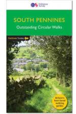
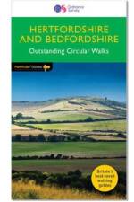
    28 circular, graded walks all tried and tested by seasoned walkers. The routes range from extended strolls to exhilarating hikes, so there is something for everyone.

  • av Neil Coates
    166

    A brand new title with 28 fabulous country walks in the southern Pennines, ranging from 3 to 10 miles with accompanying GPS references for all waypoints and clear, large scale Ordnance Survey route maps.

  • - Biography and Portraits of the City - Two-volume slipcased set
     
    3 237

    The Atlas of Ancient Rome provides a comprehensive archaeological survey of the city of Rome from prehistory to the early medieval period. Lavishly illustrated throughout with full-color maps, drawings, photos, and 3D reconstructions, this magnificent two-volume slipcased edition features the latest discoveries and scholarship, with new descriptions of more than 500 monuments, including the Sanctuary of Vesta, the domus Augusti, and the Mausoleum of Augustus. It is destined to become the standard reference for scholars, students, and anyone interested in the history of the city of Rome.The Atlas of Ancient Rome is monumental in scope. It examines the city''s topography and political-administrative divisions, trade and economic production, and social landscape and infrastructureΓÇöfrom residential neighborhoods and gardens to walls, roads, aqueducts, and sewers. It describes the fourteen regions of Rome and the urban history of each in unprecedented detail, and includes profiles and reconstructions of major monuments and works of art. This is the only atlas of the ancient city to incorporate the most current archaeological findings and use the latest mapping technologies.Authoritative and easy to use, The Atlas of Ancient Rome is the definitive illustrated reference book on Rome from its origins to the sixth century AD.Fully updated from the Italian edition to include the latest discoveries and scholarshipFeatures a wealth of maps, illustrations, and 3D reconstructionsCovers RomeΓÇÖs topography, economy, urban infrastructure, and moreIncludes profiles of major monuments and works of artDraws on the latest archaeological findings and mapping technologiesTwenty years in the making by a team of leading experts

  • av Europa Publications
    8 601

  •  
    8 091

  •  
    9 451

    Provides an in-depth library of information on the countries and territories of South Asia. This title includes a vast range of economic, political and statistical data. Combining impartial analysis with facts and figures, it provides an overall perspective on this increasingly important region.

  • - 1:25,000 OS Route Mapping
     
    147

    Map of the 79 mile (124km) Great Glen Way (one of Scotland's Great Trails), between Fort William and Inverness. This booklet is included with the Cicerone guidebook to the trail, and shows the full route on Ordnance Survey 1:25,000 maps. The route typically takes a week to walk, and is suitable for walkers at all levels of experience.

  • - 1:25,000 OS Route Mapping
     
    166

    Map of the 177 mile (283km) Offa's Dyke Path National Trail, between Sedbury (near Chepstow) and Prestatyn. The trail takes 2 weeks to walk, and is suitable for walkers at all levels of experience. This compact booklet of OS 1:25,000 maps shows the full route, providing all of the mapping you need, and is included with the guidebook.

  • av Ordnance Survey
    211

    OS Explorer is the Ordnance Survey's most detailed map and is recommended for anyone enjoying outdoor activities such as walking, horse riding and off-road cycling. The series provides complete GB coverage and can now be used in all weathers thanks to OS Explorer - Active, a tough, versatile version of OS Explorer. The OS Explorer Active range now includes a digital version of the paper map, accessed through the OS smartphone app, OS Maps.

  • av Europa Publications
    12 421

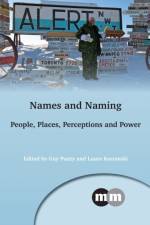
  • - People, Places, Perceptions and Power
     
    1 687

    This book explores international trends in naming and contributes to the growing field of critical onomastic enquiry. The contributors to this publication examine why names are not only symbols of a person or place, but also manifestations of cultural, linguistic and social heritage in their own right.

  • - People, Places, Perceptions and Power
     
    627

    This book explores international trends in naming and contributes to the growing field of critical onomastic enquiry. The contributors to this publication examine why names are not only symbols of a person or place, but also manifestations of cultural, linguistic and social heritage in their own right.

  • - Every Urban Train Map on Earth
    av Mark Ovenden
    337

    Using colourful graphics, this book traces the history of urban transport systems, including rare and historic maps, diagrams, and photographs.

  • av Mary Kawena Pukui & Samuel H. Elbert
    301

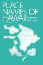
    How many place names are there in the Hawaiian Islands? Even a rough estimate is impossible. Hawaiians named taro patches, rocks, trees, canoe landings, resting places in the forests, and the tiniest spots where miraculous events are believed to have taken place. And place names are far from static--names are constantly being given to new houses and buildings, streets and towns, and old names are replaced by new ones. It is essential, then, to record the names and the lore associated with them now, while Hawaiians are here to lend us their knowledge. And, whatever the fate of the Hawaiian language, the place names will endure. The first edition of Place Names of Hawaii contained only 1,125 entries. The coverage is expanded in the present edition to include about 4,000 entries, including names in English. Also, approximately 800 more names are included in this volume than appear in the second edition of the Atlas of Hawaii.

  • - Being a Course of Three Lectures Delivered at King's College under the Auspices of the University of London
    av A. Mawer
    457

    Originally published in 1929, this book was based on a course of three lectures delivered by Mawer at King's College, Cambridge . The text provides a study of the problems and possibilities associated with the study of place names. A detailed index is also provided.

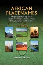
  • - Origins and Meanings of the Names for Natural Features, Towns, Cities, Provinces and Countries
    av Adrian Room
    571

  • av Robert Leader
    187

    This fascinating and beautifully photographed guidebook follows Cambridgeshire's waterways from leafy Huntingdon to the wide-sky Fens, along the lovely Nene Valley down to the busy port town of Wisbech and travels beside the gentle stream of the Cam into the architectural glories of the university city of Cambridge.

Gör som tusentals andra bokälskare

Prenumerera på vårt nyhetsbrev för att få fantastiska erbjudanden och inspiration för din nästa läsning.