- Excavations at 'Thorney Borrow Pit' 2004-2005
av Ben Pears & Andrew Mudd
507
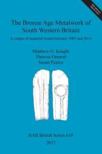
Archaeological excavation of about 11ha of land at Tower's Fen, Thorney, Peterborough (England), investigated part of an extensive pattern of ditched enclosures and fields associated with several waterholes and two ponds. One large pit, which may have been a waterhole, yielded Early Bronze Age pottery and is radiocarbon dated to the terminal 3rd millennium BC. Two other dates from the ponds came out at around 1500-1300 BC. The other features were probably also Middle to Late Bronze Age although the limited quantity of pottery was not datable precisely. Waterlogged material recovered from the deeper features included most of an unusual wooden tub or bucket, as well as other pieces of worked wood. The palaeo-environmental evidence from pollen, plant macro-fossils, insects and charred plant remains indicated that the land supported a mosaic of woodland, scrub, arable fields, meadow and short grazed grassland. A wide variety of trees was present, particularly wet-loving species such as willow and alder, and there was abundant evidence for coppicing. Nearby excavations at Pode Hole, and the wider picture provided by plotted cropmarks, indicate that the site formed part of an extensive prehistoric landscape. It is suggested that the Bronze Age agricultural landscape developed piecemeal and was based upon a mixed arable and pastoral economy. This contrasts with Fengate and other landscapes of this period where large-scale land divisions have been related to intensive livestock management. The sparse evidence for contemporaneous settlement is typical of many sites of this period.Written by Andrew Mudd and Ben Pears.Edited by Andy Richmond, Gary Coates, Andy Chapman and Pat ChapmanWith contributions from Maisie Taylor, Nick Branch, Barbara Silva, Christopher Green, Scott Elias, Alys Vaughan-Williams, Iñaki Valcarcel, Imogen Poole, Karen Deighton, Stuart Needham, Andy Chapman, Pat Chapman and Steve Critchley.Illustrations by Jacqueline Harding and Pat Walsh with Steven J. Allen.