Marknadens största urval
Snabb leverans

Böcker i OS Explorer-serien

Filter
Filter
Sortera efterSortera Serieföljd
  • - Dark Peak Area
     
    190,-

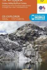
    OS Explorer is the Ordnance Survey's most detailed map and is recommended for anyone enjoying outdoor activities like walking, horse riding and off-road cycling. The OS Explorer range of OL maps now includes a digital version of the paper map, accessed through the OS smartphone app, OS Maps.

  •  
    190,-

    .

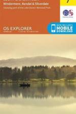
  • - Windermere, Kendal & Silverdale
     
    190,-

    .

  • - Coniston, Ulverston & Barrow-in-Furness
     
    190,-

    .

  • - Keswick, Cockermouth & Wigton
     
    190,-

    .

  • - Penzance & St Ives
     
    160,-

    OS Explorer is the Ordnance Survey's most detailed map and is recommended for anyone enjoying outdoor activities like walking, horse riding and off-road cycling. Providing complete GB coverage the series details essential information such as youth hostels, pubs and visitor information as well as rights of way, permissive paths and bridleways.

  •  
    160,-

    OS Explorer is the Ordnance Survey's most detailed map and is recommended for anyone enjoying outdoor activities like walking, horse riding and off-road cycling. The OS Explorer range of OL maps now includes a digital version of the paper map, accessed through the OS smartphone app, OS Maps.

  •  
    160,-

    OS Explorer is the Ordnance Survey's most detailed map and is recommended for anyone enjoying outdoor activities like walking, horse riding and off-road cycling. The OS Explorer range of OL maps now includes a digital version of the paper map, accessed through the OS smartphone app, OS Maps.

Gör som tusentals andra bokälskare

Prenumerera på vårt nyhetsbrev för att få fantastiska erbjudanden och inspiration för din nästa läsning.