Marknadens största urval
Snabb leverans

Böcker i Through Time-serien

Filter
Filter
Sortera efterSortera Serieföljd
  • av Liz Hanson
    201

    Peeblesshire and its attractive county town are situated in Upper Tweeddale, an area of great beauty and tranquillity. Tucked into the Borders Hills, with the River Tweed at its heart, Peebles has much to offer both tourists and residents, including walking, fishing and cycling or simply strolling along the river banks or exploring the charming high street. The city of Edinburgh is a mere 22 miles north but Peebles retains its market town identity and is very much part of The Borders. Peebles was created a Royal Burgh in 1367 by David II. Some remnants of its past are easily seen such as the thirteenth century Neidpath Castle, dramatically towering above a meander in the gorge; others remain only as traces, like the east port of the sixteenth-century town wall. This collection of photographs portrays some of the changes that have taken place to Peebles and its environs as the town has developed and grown.

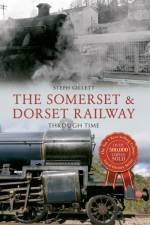
  • av Steph Gillett
    211

    The Somerset & Dorset Railway, known as the S&D (said to also stand for 'Slow and Dirty' or 'Serene and Delightful'), ran from Bath across the Mendip hills to Bournemouth on the south coast. Never a high-speed line, the main traffic for the Somerset & Dorset during the winter months was freight and local passenger traffic. In the summer, however, there was heavy traffic as Saturday holiday services from the northern industrial towns passed along the line. In 1962, John Betjeman travelled along the Somerset & Dorset from Evercreech Junction to Highbridge and Burnham-on-Sea, making a BBC documentary called Branch Line Railway, in which he pleaded for the line to be spared from the Beeching cuts. However, despite an active campaign to save it, and the promise by the new Labour government that there would be no more railway cutbacks, on 7 March 1966 the whole line was closed. 2016 will see the fiftieth anniversary of the closure of this much-mourned railway; here in this well-illustrated book, the history of the line is preserved.

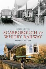
  • av Robin Lidster
    201

    The Scarborough & Whitby Railway was opened in July 1885. The 21 miles of line traversed the picturesque coast between the two towns for eighty years. There were eight stations on the line all with their own distinctive character and serving the different needs of visitors and local people. All of the stations along the route are fully illustrated in this book. The line closed in March 1965 and the buildings were later sold into private ownership and have been put to a variety of uses since that time. The aim of this book is to illustrate the changes both before and after closure along this fascinating and historical railway which has become a very popular walking and cycling trail that passes through the spectacular and varied scenery of the North Yorkshire coast.

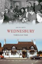
  • av Ian M. Bott
    201

    Wednesbury Through Time is a unique insight into the illustrious history of this part of the West Midlands. Reproduced in full colour, this is an exciting examination of the well-known streets and famous faces, and what they meant to the people of this area throughout the 19th and into the 20th Century. Looking beyond the exquisite exterior of these well-kept photos, readers can see the historical context in which they are set, and through the author's factual captions for every picture, and carefully-selected choice of images, the reader can achieve a reliable view of the local history. There is something for everyone here, whether they have lived in the area all their lives, or whether they are just visiting Wednesbury for the first time. Wednesbury Through Time also shows how photography has continually evolved to keep up with an ever changing society.

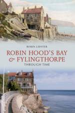
  • av Robin Lidster
    201

    Robin Hood's Bay and Fylingthorpe Through Time is a unique insight into the illustrious history of this part of Yorkshire. Reproduced in full colour, this is an exciting examination of well-known streets and famous faces, and what they meant to the people of this area throughout the 19th and into the 20th Century. Looking beyond the exquisite exterior of these well-kept photos, readers can see the historical context in which they are set, and through the author's factual captions for every picture, and carefully-selected choice of images, the reader can achieve a reliable view of the local history. There is something for everyone here, whether they have lived in the area all their lives, or whether they are just visiting for the first time. Robin Hood's Bay and Fylingthorpe Through Time also shows how photography has continually evolved to keep up with an ever changing society.

  • Spara 17%
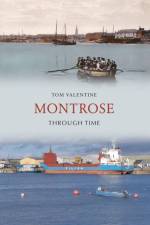
    av Tom Valentine
    167

    This fascinating selection of photographs traces some of the many ways in which Montrose has changed and developed over the last century.

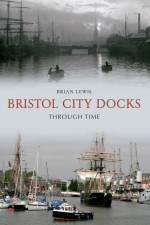
  • av Brian Lewis
    201

    The fascinating history of Bristol City Docks illustrated through old and modern pictures.

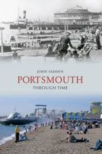
  • av John Sadden
    211

    The photographs in this fascinating collection enable the reader to explore the differences that passing time has wrought on the urban landscape of Portsmouth and Southsea, and place unrecognisable scenes in context in place and time. Archive images, including Victorian scenes, Edwardian postcards, and unique colour photographs from the 1960s and '70s, are compared and contrasted with a similar view today. These absorbing images, from professional and amateur photographers, include many street scenes alongside subjects ranging from a military band at Clarence Barracks in the 1910s, commercial shipping at the Camber in the 1930s, Billy Smart's circus in the 1950s and Dockyard pickets in the 1970s. Portsmouth Through Time is sure to evoke a wealth of personal memories and interest to anyone who knows and loves the city and would enjoy a trip into its recent past.

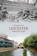
  • av Stephen Butt
    201

    Leicester Through Time is a unique insight into the illustrious history of this part of the country. Reproduced in full colour, this is an exciting examination of Leicester, the famous streets and the famous faces, and what they meant to the people of Leicester throughout the 19th and into the 20th Century. Looking beyond the exquisite exterior of these well-kept photos, readers can see the historical context in which they are set. Through the author's factual captions for every picture, and carefully-selected choice of images, the reader can achieve a reliable view of the city's history. Readers are invited to follow a timeline of events and watch the changing face of Leicester, as the author guides us through the city's streets. There is something for everyone here, whether they have lived in Leicester all their lives, or whether they are just visiting this vibrant city. It also shows how photography has continually evolved to keep up with an ever changing society.

  • av Peter Tuffrey
    211

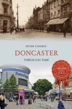
    Doncaster has always benefited from its location. It stands on the Great North Road, superseded by the A1, the primary route for all traffic from London to Edinburgh, and due to its strategic geographical importance it emerged as an industrial centre in the mid-nineteenth century. Beneath the town lies a huge coal seam and it was this that prompted Doncaster's exponential population growth. In the early part of the twentieth century Doncaster became one of the largest coal-mining areas in the country, with the industry becoming one of the most significant local employers. However, along with many other areas, a large number of mining jobs were lost in the mid-1980s, and several pits closed. Today, coal mining has been eliminated with no collieries surviving. The demise of coal saw a domino effect that led to the removal of many other tertiary industries. In recent years, however, the city's fortunes have changed. Its centre has undergone redevelopment including the construction of an Education City campus, currently the largest education investment of its kind in the UK. The Doncaster Lakeside, incorporating Doncaster Rovers at the Keepmoat Stadium, is a massive new development and the ever-popular 'Dome', opened in 1989 by Princess Diana, contains a state of the art swimming pool, gym and ice rink. The Frenchgate Centre, a shopping centre and transport interchange, has also been extended to connect with the railway station and bus station. The Waterdale area of the town centre is currently undergoing rejuvenation, with a new theatre (known as CAST), new civic offices and a new public square already having been completed, on part of the site of the old Waterdale car park. These changes, and many more, are all documented in Peter Tuffrey's fascinating collection of old and new photographs of Doncaster.

  • Spara 12%
    av Michael Richardson
    190,99

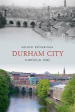
    Durham City Through Time is a unique insight into the illustrious history of this part of the country. Reproduced in full colour, this is an exciting examination of Durham City, the famous streets and the famous faces, and what they meant to the people of this area throughout the 19th and into the 20th Century. Looking beyond the exquisite exterior of these well-kept photos, readers can see the historical context in which they are set and through the author's factual captions for every picture, and carefully-selected choice of images, the reader can achieve a reliable view of this city's history. Readers are invited to follow a timeline of events and watch the changing faces of Durham City, as Michael Richardson guides us through the streets of this city. There is something for everyone here, whether they have lived in this area all their lives or whether they are just visiting the area. It also shows how photography has continually evolved to keep up with an ever-changing society.

  • av Tony Lancaster
    211

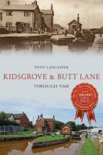
    At the northern end of the borough of Newcastle-under-Lyme, Kidsgrove and Butt Lane were quiet and rural areas of scattered settlements that became an industrial centre of great importance in the economy of North Staffordshire. Today, the areas are largely residential, with housing belonging mainly from the post-war era onwards. Coal mines and ironworks changed the landscape and population and housing increased; development by the Trent and Mersey Canal and the arrival of the railway allowed the area to flourish. Nowadays, most of the heavy industry has declined and many once-familiar sights have been swept away. However, it is possible to recreate something of the atmosphere of this industrial past and its social consequences through the illustrations and detail that accompany them. Drawing on a rich store of photographs and historical information, this book reveals a fascinating past for readers to enjoy as local author Tony Lancaster guides us through the streets, revealing the changing faces of Kidsgrove and Butt Lane.

  • av Steven Dickens
    201

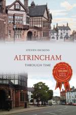
    The market town of Altrincham, historically a part of Cheshire but now part of the metropolitan borough of Trafford, has a rich history. The name Altrincham is derived from Old English, meaning the homestead of Aldhere's people. The Roman road to Chester ran through Altrincham, but there is no evidence that the Romans ever settled in the market town. Altrincham's market was created by charter in 1290 and in medieval times a court leet was established. The town eventually became a borough in 1886, with an elected council. Hamon de Massey was given land in the area by William the Conqueror and the de Masseys remained influential until the male line died out in the fifteenth century. From the de Masseys the estate passed to Robert del Boothe of Barton upon Irwell and in 1627 the Earls of Stamford became Lords of the Manor, rebuilding Dunham Massey Hall, which they left in 1855, returning to Altrincham 1906. The estate was bequeathed to the National Trust in 1976. Join local historian Steven Dickens as he looks at this history and shows, through a beautiful collection of photographs, how this charming market town has altered over time.

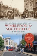
  • av Simon McNeill-Ritchie & Ron Elam
    297

    The district of Wimbledon has become synonymous with its world-famous tennis tournament held here since 1922. This part of south-west London has been inhabited since the Iron Age and has developed over the centuries into two distinct parts: the 'village' and the 'town'. The village developed first as it began to attract wealthy merchants from the city but the arrival of the London & South West Railway in 1838 saw the focus of subsequent developments shift away from the original village towards the town, which is now the main retail centre. Southfields, meanwhile, was still a largely an area of fields between the villages of Wimbledon and Putney until the coming of the railway in the late nineteenth century, connecting Wimbledon to Putney Bridge. Using a selection of old and new photographs, local historians Simon McNeill-Ritchie and Ron Elam trace the distinct journeys of these two suburban districts over the past century, making this book essential reading for anyone who knows and loves this famous part of south London.

  • av Gill Jepson
    211

    Barrow-in-Furness is a small post-industrial town at the end of a long peninsula in the north of England. Its isolated location has produced a stalwart and close population. It started life as a small hamlet and grew to become an industrial leader, first in iron and steel and later in ship-building and engineering, drawing a workforce from all over the country. The ship-building industry continues to be a major employer but today there is less diversity than in Barrow's heyday. Although the town is known for its industry, it sits in one of the most beautiful areas of Cumbria. It boasts a rich heritage and spectacular views to the Lake District and across Morecambe Bay and, surrounded on three sides by the sea, it enjoys its own temperate climate. Furness Abbey was a great influence on the area in the medieval period and there are castles, churches, monuments and memories just waiting to be discovered by the unsuspecting visitor.

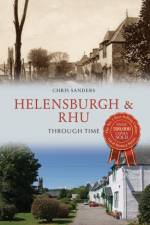
  • av Christopher Sanders
    201

    Helensburgh's history begins on the 11 January 1776 when Sir James Colquhoun of Luss, on the shore of Loch Lomond, advertised land to be divided into building plots on the south-facing slope overlooking the Clyde. The town, called after Lady Helen Colquhoun, received a royal charter in 1802 and developed rapidly on a planned grid pattern during the nineteenth century. Henry Bell's Comet, the first seagoing steam ship in the world, started a commuter service to Glasgow in 1812, making the town, with its fine views over the sea, an attractive place to live. By Edwardian times, a large number of fine houses, some designed by important architects, had been built up the hill, culminating in The Hill House, Charles Rennie Mackintosh's masterpiece. Between the wars and in the '50s and '60s, Helensburgh was a very popular resort for day trips 'doon the watter' from Glasgow, and though this has now declined, the proximity to the Loch Lomond National Park and sailing on the Clyde means it is still a major holiday destination. The town is close to the adjacent naval base at Faslane and combines maritime traditions with fine streets filled with clouds of cherry blossom in spring.

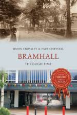
  • av Paul Chrystal & Simon Crossley
    201

    Bramhall is a thriving, bustling and leafy suburb of Stockport, close to Manchester. It has been voted the least 'lonely place' in Britain; according to research from the University of Sheffield, Bramhall came bottom of the loneliness index nationwide. It has a rich history stretching back to the Anglo-Saxon period. This book takes us back to Bramhall's early days to meet Saxons Brun and Hacun, whose lands were given by Willliam the Conqueror to Hamon de Massey, who eventually became 1st Baron of Dunham Massey. The Edwardian shops and businesses in the village centre have been replaced by trendy boutiques and cool bars, but old Bramhall is still characterised by the grand Bramall Hall, with its beautiful park, as well as the town's many farms and old pubs. The book also takes in neighbouring Cheadle and Cheadle Hulme, Gatley, Hazel Grove and Manchester International Airport in Ringway, where old and new pictures are juxtaposed to show how things have changed in these communities.

  • av Paul Chrystal
    201

    This fascinating selection of photographs traces some of the many ways in which Central Leeds has changed and developed over the last century.

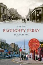
  • av Brian King
    211

    Broughty Ferry has gone through many changes since its origins as a small fishing village nestled in the shadow of a fifteenth-century castle. The industrial age saw wealthy jute barons arrive and build their grand residences there, while the coming of the train saw the town become a popular destination for holidaymakers. The twentieth century and beyond has seen Broughty Ferry evolve into a popular and affluent suburb. This compilation of images follows Broughty Ferry through all of these changes and shows how, despite officially becoming part of Dundee in 1913, 'the Ferry' has always maintained an independent air.

  • av Jack Gillon
    201

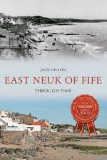
    Neuk is the Scots word for nook or corner, and the delightful East Neuk, with its string of picturesque fishing and farming villages, is one of the most attractive parts of the country to investigate. Few regions present a greater number of attractions than the East Neuk with its sandy beaches, wild and precipitous cliffs, remarkable caves, celebrated golf links, notable churches, historic castles and historical associations. These villages, running from from Crail to Largo, are quite distinct from those of any other part of Scotland and have stood almost unchanged for centuries and thus present, in their uneven, angular streets, red-tiled roofs and crow-stepped gables, an accurate representation of the ancient burghs of our past.

  • av Michael J. Hallowell
    201

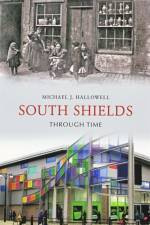
    South Shields Through Time is a unique insight into the illustrious history of one of England's finest cities. Reproduced in full colour, this is an exciting examination of South Shields, the famous streets and the famous faces, and what they meant to the people of South Shields throughout the 19th and into the 20th Century. Looking beyond the exquisite exterior of these well-kept photos, readers can see the historical context in which they are set, and through the author's factual captions for every picture and carefully-selected choice of images, the reader can achieve a reliable view of the city's history. Readers are invited to follow a timeline of events and watch the changing face of the city, as Mike Hallowell guides us through the city streets. There is something for everyone here, whether they have lived in South Shields all their lives, or whether they are just visiting this fabulous city. It also shows how photography has continually evolved to keep up with an ever-changing society.

  • av Alyson Wilson & Claire Fry
    211

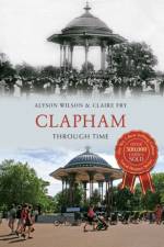
    In ancient times Clapham was a secluded Surrey village, clustered round a manor house and church. By the seventeenth century, the wealthy of London were building houses here as rural retreats and, by 1800, their mansions in extensive grounds surrounded Clapham Common, which was becoming a place of recreation. The development of the railways in the nineteenth century meant that families who could afford large houses moved further out to the countryside, selling off their ground to developers who built the terraced houses which cover the area today. Around forty years ago, after a period of neglect and bomb damage from the Second World War, the area started to become 'gentrified' and is now a desirable London suburb. Clapham Through Time traces these changes over the years. A few mansions have survived and been put to new uses, several churches lost during the war have been replaced, Clapham Common is recognisable though used quite differently, but the greatest change is in the appearance of the ordinary streets - the shop fronts, vehicles and people. Many who have arrived in Clapham during the last few years will be amazed by its former appearance!

  • av Robert Turcan
    201

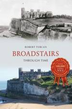
    Broadstairs is rightly known as 'the jewel in Thanet's crown'. This most easterly, quintessentially English seaside resort exudes much charm. Its sandy beaches provide wonderful opportunities for family bathing. Late Regency and more predominantly Victorian or Edwardian buildings reflect growth following railway expansion. Historically, the town's name was linked to broad stairs which were cut into steep cliffs above its shoreline, leading to an ancient religious shrine. A fishing village with smuggling activities is all that existed in Georgian times. By 1815 it was here that the exultant news of victory at Waterloo first reached our country. Later in the nineteenth century Charles Dickens frequented the borough. There are two museums relating to his life and great works. Festivals marking his visits along with food ftes enliven summer gaiety. All these vivid scenes are pictured within this collection of scenes, past and present. They are a colourful illustration of how time has kindly preserved and simply enhanced this Kentish gem.

  • av Mary Smith & Allan Devlin
    201

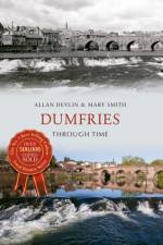
    Dumfries, a market town in south-west Scotland known as the Queen of the South, is the administrative capital of the Dumfries and Galloway region and has a population of almost 32,000. Dumfries has a turbulent and sometimes bloody history with links to the Roman occupation of Britain, Bonnie Prince Charlie's failed Jacobite uprising, the colonisation of America and imperialism. Most famously Scotland's bard, Robert Burns, spent his final years in Dumfries with many places in the town having connections to the poet. Its thriving port trade is now a thing of the past and although once one of the largest tweed producers in the world, it has never been a major industrial centre. The photographs show that much has changed in Dumfries - not always for the better. Some of the photographs in this collection have special poignancy as many historical buildings have been demolished in the name of progress. Doonhamers are proud of their town and its history. Dumfries Through Time hopes to demonstrate the importance of the town's built heritage and is essential reading for anyone interested in the history of Dumfries.

  • av Alan Myatt
    201

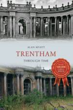
    Home to earls, marquises and dukes, where church towers and bells disappeared and rivers changed course, Trentham has many stories to tell. Known as the 'playground of the Midlands', over the years Trentham has been frequented by kings and leaders such as Benjamin Disraeli and Winston Churchill. A place of sylvan parkland and manicured gardens, the Trentham Estate features a huge mausoleum and the Italianate gardens remain a popular tourist destination. Today Trentham forms a bustling southern suburb of Stoke-on-Trent, but has maintained its own distinct identity over the years. Within a mile of the Staffordshire Potteries, Trentham continues to draw visitors from far and wide keen to discover its rich history. Join author Alan Myatt on a tour of Trentham's past and present, highlighting the area's many points of interest. Trentham Through Time is an essential volume for anyone who knows and loves this area.

  • av Jenny McRonald
    201

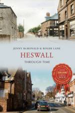
    This fascinating selection of photographs traces some of the many ways in which Heswall has changed over the last century.

  • av Hailsham Historical Society
    201

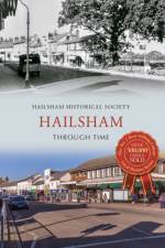
    Hailsham, the largest of the main towns in the Wealden District of East Sussex, is an inviting market town, rich in industrial and agricultural history. During the nineteenth and twentieth centuries, ropemaking was a major local industry and it still continues in the town today. Granted a Market Charter in 1252 by Henry III, this town has a long and varied heritage with weekly livestock markets, a monthly farmers' market and weekly street markets continuing to operate in the town and which also serve the wider rural population. St Mary's Church, a mainly fifteenth-century building with an attractive chequerwork stone and knapped flint tower, still stands in the heart of the town. In 2012 Hailsham Market was saved from development after the freehold of the site was purchased, ending over a decade of uncertainty regarding the future of the market. Many areas in and around Hailsham have changed through time, especially in recent years when housing developments have stretched the town boundaries and new shopping precincts have been built in the town centre. However, there are still many original buildings, some of which are believed to date back to the fifteenth century, in and around the High Street and Market Square. In this volume, the members of the Hailsham Historical Society provide readers with an insight into the history of the area and show what life was like for past residents through this fascinating selection of old and modern photographs.

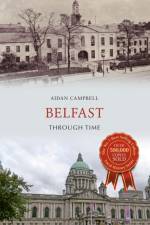
  • av Aidan Campbell
    211

    Belfast (Irish: Beal Feirste 'mouth of the sandbank ford') is the capital city of Northern Ireland. The site of Belfast has been described as 'not built on a perfect site' given that the original settlement was located on low-lying land on the Co. Antrim side of the River Lagan. It was during the Victorian period that wealthy business owners moved out of the old town and built grand villas on the hills surrounding the city. There are views of big houses, grand public buildings and churches, schools, public transport including trams, trolleybuses and steam trains, factories and suburbia. Many of these scenes are remarkably unchanged and much of the character of the bustling industrial city remains, while many locations have been swept away and are unrecognisable following recent redevelopments.

Gör som tusentals andra bokälskare

Prenumerera på vårt nyhetsbrev för att få fantastiska erbjudanden och inspiration för din nästa läsning.