Marknadens största urval
Snabb leverans

Böcker av Andrew Tibbs

Filter
Filter
Sortera efterSortera Populära
  • - Empire of Water
    av Andrew Tibbs
    2 016,-

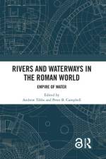
    Taking a broad geographical, temporal, and cross-disciplinary approach, this volume explores new and innovative research which focuses on rivers and waterways from across the Roman world.Rivers and Waterways in the Roman World brings together cross-disciplinary chapters focussing on theoretical approaches, new digital and scientific methods and analytical techniques, and related surveying and excavation case studies to examine the Romans' extensive use of rivers and inland waterways around the Empire. Roman seafaring is well studied, but this book expands our knowledge of Roman transport, communication, and trade networks inland. The book highlights the challenges of archaeological work in the dynamic environments of rivers and waterways and showcases the use of new methodologies, including the increasing availability and accessibility of digital technologies that have led to a growth in the development and application of new archaeological and analytical techniques, as well as the discovery of new archaeological sites, many of which were previously inaccessible.This book is for archaeologists, historians, classicists, and geographers with an interest in the history and archaeology of the Roman Empire.Chapter 15 of this book is freely available as a downloadable Open Access PDF at http: //www.taylorfrancis.com under a Creative Commons Attribution-Non Commercial-No Derivatives (CC-BY-NC-ND) 4.0 license.

  • av Andrew Tibbs
    246,-

    An illustrated, readable companion and indispensable guide to Roman London, both visible and beneath your feet.

  • av Andrew Tibbs
    200,-

    A revealing guide to the early Roman fortifications in Scotland. From an acknowledged expert on the Roman military in Scotland.

  • av Andrew Tibbs
    910,-

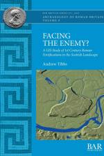
    Facing the Enemy is a GIS-based examination of the relationship between Roman fortifications occupied during the Flavian period (AD 77-86/90), and their Scottish landscape setting. It undertakes spatial analysis of the positioning, orientation, intervisibility and interconnectivity of the early legionary fortresses, forts, fortlets, camps and towers. The study combines mapping data, remote sensing technologies, along with archaeological evidence in an extensive GIS database, and takes a systematic approach to analysing the landscapes surrounding the fortifications.The work demonstrates that Flavian fortifications were almost always located in positions which enabled the military to control movement through the landscape, with coastal sites frequently guarding access to river networks and fortifications further upstream. The study concludes that the military strategy in Flavian Scotland was not to block all movement through the landscape as such a strategy would have been impossible in such a varied setting, but rather to control the main corridors of movement, and by extension, exert control and authority over the indigenous population.

Gör som tusentals andra bokälskare

Prenumerera på vårt nyhetsbrev för att få fantastiska erbjudanden och inspiration för din nästa läsning.