Marknadens största urval
Snabb leverans

Böcker av Christoph Tschaikner

Filter
Filter
Sortera efterSortera Populära
  • av Christoph Tschaikner
    386,-

    Via Claudia Augustawith car, camper, bus, ..."Altinate" and "Padana" in one book+ GPX track on www.viaclaudia.orgDonauwörth - Lech - Augsburg - Landsberg am Lech - Schongau - Allgäu - Füssen - Reutte - Tyrolean Zugspitz - Fernpass - Gurgltal - Imst - Inntal - Landeck - Tyrolean Oberland - Reschenpass - Vischgau - Merano - Burgrafenamt - Bolzano - South Tyrolean Wine Route - Piana Rotaliana - TrentoVarinate "ALTINATE": - Valsugana - Tesino High Valley - Dolomiti Bellunesi National Park - Feltre - Valbelluna - Prosecco Wine Road - Montello and Colli Asolani Wine Road - Treviso - Sile Nature Park - Altino - Venetian Lagoon - Venice - JesoloVarinate "PADANA": - Vallagarina - Rovereto - Lake Garda - Valpolicella - Verona - Po Valley - Ostiglia on the Po RiverGuide for a successful discovery tripECONOMY = maps in color, city maps and other pages in black and white(alternatively there is also PREMIUM = all pages except city maps and text pages in color, BUDGET = black and white)The heart of the guide is the 62 color maps in 1:50:000 format and 14 even more detailed maps of the cities with an ideal circular route. The short historical introduction and over 500 photos and other illustrations serve to set the mood for the trip.In the appendix of the cycling tour book there is a compilation of 200 selected hosts, with indication of the map where you can find them as well.The route for car, camper, bus, etc. leads along picturesque country roads and romantic mountain roads, through interesting places and towns with many sights, and impresses with its great variety:Every few kilometers a new landscape3 countries, 2 languagesa variety of different cultures3 climatic zonesAt the end of April, beginning of May you can even experience 3 seasons: A last snowfield in a shady spot at the Fernpass, sunbathing in the very south and all the shades of spring on the way.In autumn you can discover the freshly harvested delicacies, which grow in great variety along the route and are processed into specialtieshttps://www.viaclaudia.org/radtour/detaillierte-routen-beschreibung-padana.htmlThe Via Claudia Augusta follows the first Europe-connecting road across the Alps, to which the Romans added the paths of the Etruscans, Venetians, Councillors

  • av Christoph Tschaikner
    296,-

    Via Claudia Augustawith car, camper, bus, ..."Altinate" and "Padana" in one book+ GPX track on www.viaclaudia.orgDonauwörth - Lech - Augsburg - Landsberg am Lech - Schongau - Allgäu - Füssen - Reutte - Tyrolean Zugspitz - Fernpass - Gurgltal - Imst - Inntal - Landeck - Tyrolean Oberland - Reschenpass - Vischgau - Merano - Burgrafenamt - Bolzano - South Tyrolean Wine Route - Piana Rotaliana - TrentoVarinate "ALTINATE": - Valsugana - Tesino High Valley - Dolomiti Bellunesi National Park - Feltre - Valbelluna - Prosecco Wine Road - Montello and Colli Asolani Wine Road - Treviso - Sile Nature Park - Altino - Venetian Lagoon - Venice - JesoloVarinate "PADANA": - Vallagarina - Rovereto - Lake Garda - Valpolicella - Verona - Po Valley - Ostiglia on the Po RiverGuide for a successful discovery tripBUDGET = black and white(alternatively there is also PREMIUM = all pages except city maps and text pages in color, ECONOMY = maps in color, city maps and other pages in black and white)The heart of the guide is the 62 maps in 1:50:000 format and 14 even more detailed maps of the cities with an ideal circular route. The short historical introduction and over 500 photos and other illustrations serve to set the mood for the trip.In the appendix of the cycling tour book you will find a compilation of 200 selected hosts, with indication of the map where you can find them as well.The route for car, camper, bus, etc. leads along picturesque country roads and romantic mountain roads, through interesting places and towns with many sights, and impresses with its great variety:Every few kilometers a new landscape3 countries, 2 languagesa variety of different cultures3 climatic zonesAt the end of April, beginning of May you can even experience 3 seasons: A last snowfield in a shady spot at the Fernpass, sunbathing in the very south and all the shades of spring on the way.In autumn you can discover the freshly harvested delicacies, which grow in great variety along the route and are processed into specialtieshttps://www.viaclaudia.org/radtour/detaillierte-routen-beschreibung-padana.htmlThe Via Claudia Augusta follows the first road across the Alps that connected Europe, to which the Romans added the paths of the Etruscans, Venetians, Councils

  • av Christoph Tschaikner
    486,-

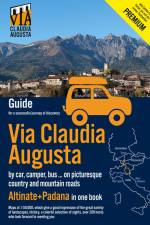
    Via Claudia Augustaby car, camper, bus, ..."Altinate" and "Padana" in one book+ GPX track on www.viaclaudia.orgDonauwörth - Lech - Augsburg - Landsberg am Lech - Schongau - Allgäu - Füssen - Reutte - Tyrolean Zugspitz - Fernpass - Gurgltal - Imst - Inntal - Landeck - Tyrolean Oberland - Reschenpass - Vischgau - Merano - Burgrafenamt - Bolzano - South Tyrolean Wine Road - Piana Rotaliana - TrentoVarinate "ALTINATE": - Valsugana - Tesino High Valley - Dolomiti Bellunesi National Park - Feltre - Valbelluna - Prosecco Wine Road - Montello and Colli Asolani Wine Road - Treviso - Sile Nature Park - Altino - Venetian Lagoon - Venice - JesoloVarinate "PADANA": - Vallagarina - Rovereto - Lake Garda - Valpolicella - Verona - Po Valley - Ostiglia on the Po RiverGuide for a successful discovery tripPREMIUM = all pages except city maps and text pages in color(alternatively there is also ECONOMY = maps in color, city maps and other pages in black and white, BUDGET = black and white)The heart of the guide is the 62 color maps in 1:50:000 format and 14 even more detailed maps of the cities with an ideal itinerary. The short historical introduction and over 500 photos and other illustrations serve to set the mood for the trip.In the appendix of the cycling tour book there is a compilation of 200 selected hosts, with indication of the map where you can find them as well.The route for car, camper, bus, etc. leads along picturesque country roads and romantic mountain roads, through interesting places and towns with many sights, and impresses with its great variety:Every few kilometers a new landscape3 countries, 2 languagesa variety of different cultures3 climatic zonesAt the end of April, beginning of May you can even experience 3 seasons: A last snowfield in a shady spot at the Fernpass, sunbathing in the very south and all the shades of spring on the way.In autumn you can discover the freshly harvested delicacies, which grow in great variety along the route and are processed into specialtieshttps://www.viaclaudia.org/radtour/detaillierte-routen-beschreibung-padana.htmlThe Via Claudia Augusta follows the first Europe-connecting road across the Alps, to which the Romans added the paths of the Etruscans, Venetians, Councillors

  • - Leitfaden fur eine gelungene Entdeckungs-Reise (schwarz-weiss)
    av Christoph Tschaikner
    256,-

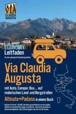
  • - Leitfaden fur eine gelungene Entdeckungs-Reise (Karten in Farbe, Stadtplane und ubrige Seiten in schwarz-weiss)
    av Christoph Tschaikner
    310,-

  • - Leitfaden fur eine gelungene Entdeckungs-Reise (alle Seiten ausser Textseiten und Stadtplane in Farbe)
    av Christoph Tschaikner
    410,-

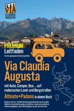
    Via Claudia Augustamit Auto, Camper, Bus, ..."Altinate" und "Padana" in einem Buch+ GPX-Track auf www.viaclaudia.orgDonauwörth - Lech - Augsburg - Landsberg am Lech - Schongau - Allgäu - Füssen - Reutte - Tiroler Zugspitz - Fernpass - Gurgltal - Imst - Inntal - Landeck - Tiroler Oberland - Reschenpass - Vischgau - Meran - Burgrafenamt - Bozen - Südtiroler Weinstraße - Piana Rotaliana - TrentoVariante "ALTINATE": - Valsugana - Hochtal Tesino - Nationalpark Dolomiti Bellunesi - Feltre - Valbelluna - Prosecco Weinstraße - Weinstraße Montello und Colli Asolani - Treviso - Sile-Naturpark - Altino - venetianische Lagune - Venedig - JesoloVarinate "PADANA": - Vallagarina - Rovereto - Gardasee - Valpolicella - Verona - Po-Ebene - Ostiglia am PoLeitfaden für eine gelungene Entdeckungs-ReisePREMIUM = alle Seiten bis auf Stadtpläne und Textseiten in Farbe(alternativ gibt es auch ECONOMY = Karten in Farbe, Stadtpläne und andere Seiten in schwarz-weiß, BUDGET = schwarz-weiss)Herzstück des Reiseführers sind die 62 farbige Karten im Format 1:50:000 und 14 noch detaillierteren Karten der Städte mit einem idealen Rundweg. Die kurze geschichtliche Einleitung und über 500 Fotos und andere Abbildungen dienen der Einstimmung auf die ReiseIm Anhang des Radtourenbuches findet sich eine Zusammenstellung von 200 ausgewählten Gastgebern, mit Angabe der Karte, in der Sie sie sie ebenfalls finden.Die Route für Auto, Camper, Bus, usw. führt auf malerischen Landstraßen und romantischen Bergstraßen, durch interessante Orte und Städte mit vielen Sehenswürdigkeiten, und besticht mit ihrer großen Vielfalt:Alle paar Kilometer eine neue Landschaft3 Länder, 2 Spracheneine Vielzahl von unterschiedlichen Kulturen3 KlimazonenEnde April, Anfang Mai kann man sogar mitunter 3 Jahreszeiten erleben: Ein letztes Schneefeld an einer schattigen Stelle am Fernpass, Sonnenbaden ganz im Süden und alle Schattierungen des Frühjahres unterwegsIm Herbst kann man die frisch geernteten Köstlichk

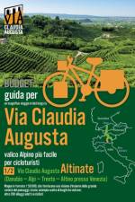
  • - Guida per un magnifico viaggio in bici (in bianco e nero)
    av Christoph Tschaikner
    266,-

  • - Leitfaden fur eine gelungene Rad-Reise (schwarz-weiss)
    av Christoph Tschaikner
    256,-

    RadrouteVia Claudia Augusta+ GPX-Track auf www.viaclaudia.orgVariante 2 von 2"Padana"Bayerische Donau - Lech - Tiroler Alpentäler - Etschtal - Gardasee - Verona - Ostiglia am Po(alternativ gibt es auch einen Radführer zur "Altinate" von der bayerischen Donau bis Altino bei Venedig)leichtester Alpenübergang für Tourenradfahrerbeliebteste grenzüberschreitende Radtour der Deutschenvier Sterne des ADFCRadreisende von allen Kontinenten zwischen 5 und 93 JahrenLeitfaden für eine gelungene RadreiseBUDGET = schwarz-weiß(alternativ gibt es auch PREMIUM = alle Karten, Fotos und weiteren Abbildungen in Farbe sowie praktische Spiralbindung, ECONOMY = Karten in Farbe und praktische SpiralbindungHerzstück des Radreiseführers sind die 45 Karten im Format 1:50:000. Sie sind so gestaltet, dass Sie während des Tages rein mit den Karten das Auslangen finden. Sie zeigen die Route inkl. Abzweigungen, die Sehenswürdigkeiten und sogar Gastgeber, die sich auf Reisende entlang der Via Claudia Augusta eingestellt haben. Die Spiralbindung ermöglicht, die entsprechende Kartenseite dauerhaft aufzuschlagen und den Bikeguide so auch in eine Schutzhülle zu geben.Die kurze geschichtliche Einleitung des Radguides und über 500 Fotos und andere Abbildungen dienen der Einstimmung auf die RadrouteIm Anhang des Radtourenbuches findet sich eine Zusammenstellung von 200 ausgewählten Gastgeber, von Nord nach Süd geordnet, mit Angabe der Karte, in der Sie den Gastgeber finden.Die Radroute besticht mit ihrer Vielfalt:alle paar Kilometer eine neue Landschaft3 Länder, 2 Spracheneine Vielzahl von unterschiedlichen Kulturen3 KlimazonenEnde April, Anfang Mai kann man sogar mitunter 3 Jahreszeiten erleben: Ein letztes Schneefeld an einer schattigen Stelle am Fernpass, Sonnenbaden ganz im Süden und alle Schattierungen des Frühjahres unterwegsIm Herbst kann man die frisch geernteten Köstlichkeiten entdecken, die entlang der Route in großer Vielfalt wachsen und zu Spezialitäten verarbeitet werdenhttps://www.viaclaudia.org/radtour/detaillierte-routen-beschreibung-padana.htmlDie Via Claudia Augusta folgt der ersten europaverbindenden Straße über die Alpen, zu der die Römer die Wege der Etrusker, Veneter, Räter und Kelten ausgebaut haben und zeigt all das, was die Straße in Tausenden Jahren - in der Ur- und Frühgeschichte, in der Römerzeit, im Mittelalter, in der Neuzeit - mitgeprägt hat.

  • - Leitfaden fur eine gelungene Rad-Reise (schwarz-weiss)
    av Christoph Tschaikner
    266,-

    RadrouteVia Claudia Augusta+ GPX-Track auf www.viaclaudia.orgVariante 1 von 2"Altinate"Bayerische Donau - Lech - Tiroler Alpentäler - Etschtal - Trento - Valsugana - Feltre - Praderadego - Piave - Treviso - Altino - Lagune von Venedig(alternativ gibt es auch einen Radführer zur "Padana" von der bayerischen Donau bis Ostiglia am Po)leichtester Alpenübergang für Tourenradfahrerbeliebteste grenzüberschreitende Radtour der Deutschenvier Sterne des ADFCRadreisende von allen Kontinenten zwischen 5 und 93 JahrenLeitfaden für eine gelungene RadreiseBUDGET = schwarz-weiß(alternativ gibt es auch PREMIUM = alle Karten, Fotos und weiteren Abbildungen in Farbe sowie praktische Spiralbindung, ECONOMY = Karten in Farbe und praktische Spiralbindung)Herzstück des Radreiseführers sind die 49 Karten im Format 1:50:000. Sie sind so gestaltet, dass Sie während des Tages rein mit den Karten das Auslangen finden. Sie zeigen die Route inkl. Abzweigungen, die Sehenswürdigkeiten und sogar Gastgeber, die sich auf Reisende entlang der Via Claudia Augusta eingestellt haben. Die Spiralbindung ermöglicht, die entsprechende Kartenseite dauerhaft aufzuschlagen und den Bikeguide so auch in eine Schutzhülle zu geben.Die kurze geschichtliche Einleitung des Radguides und über 500 Fotos und andere Abbildungen dienen der Einstimmung auf die RadrouteIm Anhang des Radtourenbuches findet sich eine Zusammenstellung von 200 ausgewählten Gastgeber, von Nord nach Süd geordnet, mit Angabe der Karte, in der Sie den Gastgeber finden.Die Radroute besticht mit ihrer Vielfalt:alle paar Kilometer eine neue Landschaft3 Länder, 2 Spracheneine Vielzahl von unterschiedlichen Kulturen3 KlimazonenEnde April, Anfang Mai kann man sogar mitunter 3 Jahreszeiten erleben: Ein letztes Schneefeld an einer schattigen Stelle am Fernpass, Sonnenbaden ganz im Süden und alle Schattierungen des Frühjahres unterwegsIm Herbst kann man die frisch geernteten Köstlichkeiten entdecken, die entlang der Route in großer Vielfalt wachsen und zu Spezialitäten verarbeitet werdenhttps://www.viaclaudia.org/radtour/detaillierte-routen-beschreibung-altinate.htmlDie Via Claudia Augusta folgt der ersten europaverbindenden Straße über die Alpen, zu der die Römer die Wege der Etrusker, Veneter, Räter und Kelten ausgebaut haben und zeigt all das, was die Straße in Tausenden Jahren - in der Ur- und Frühgeschichte, in der Römerzeit, im Mittelalter, in der Neuzeit - mitgeprägt hat.
Gör som tusentals andra bokälskare

Prenumerera på vårt nyhetsbrev för att få fantastiska erbjudanden och inspiration för din nästa läsning.