Marknadens största urval
Snabb leverans

Böcker av David Burch

Filter
Filter
Sortera efterSortera Populära
  • - Getting Started with Electronic Navigational Charts
    av David Burch
    296,-

    By the end of 2024, electronic navigational charts (ENC) are projected to be the only official NOAA charts, and all traditional paper charts will have been discontinued and NOAA is on schedule to remove the rest as announced. These charts are being replaced by new (reschemed) versions of electronic navigational charts (ENC) that have been in use for over 15 years in ocean shipping, but have not been used much by recreational and other commercial mariners.As of October, 2023, over 60% of paper charts have been permanently removed, and hundreds of new ENC have replaced them.ENC contain much more information than paper charts do, they are easier to keep up to date, and they add notable safety features to navigation-each chart is a dynamic prescription for drawing the chart that knows where all hazards lie, and therefore our electronic chart system (ECS) in use can warn us of their approach.But ENC look different and are structured differently than paper charts. The safe use of ENC requires new knowledge on charts and chart reading.This booklet is a quick guide to how to use these powerful electronic charts, which will very shortly be what we mean when we say "nautical chart."

  • av David Burch
    640,-

    There are two types of electronic charts: raster navigational charts (RNC) and electronic navigational charts (ENC). RNC are exact copies of paper charts and their use underway comes naturally to navigators accustomed to paper charts. All traditional paper charts, however, and their RNC are being discontinued by NOAA. Many are gone already and all will be gone in a year or so.ENC (also called vector charts), on the other hand, include much more information than RNC; they allow user-selected display options that enhance safety and efficiency; and they are easier to keep up to date. But they do not look like traditional charts, and they do not behave like traditional charts. Navigation with ENC is fundamentally different from navigation with paper charts or RNC.Electronic charting benefits all mariners, professional and recreational, large vessels and small, power and sail, racing and cruising. The unique information in this book should help mariners in any of these categories master the use of ENC to enhance their safety and performance underway. There are many virtues of ENC, but to take advantage of these, a new approach to "reading charts" is called for. This book explains and illustrates the process.From the Forward to the Second EditionTwo primary factors have taken place since the first edition that affect the content of this book. Foremost is the ongoing NOAA program to redesign the layout of all ENC to make them more consistent amongst themselves and with the ENC from other nations. This is a major improvement. The process is called rescheming. The most apparent changes are the shapes and coverages of the individual charts, which, when reschemed, become regular and consistent. Chart scales and depth contour conventions are also improved, plus we get a larger (more detailed) compilation scale for many areas.On top of these changes, the USCG has just completed a call for comments on the proposed new ruling that vessels must have some electronic chart viewer on board to effectively read the official ENC. In other words, we are at the moment when ENC have gone from an optional substitute for paper charts to being a required method of navigation. With all of this going on, we can see why NOAA decided it was time to take on the daunting task of rescheming all of the US ENC.We have added an appendix on rescheming to cover the details of the changes and how we recognize them in conjunction with what we now call the legacy ENC that exist before rescheming. The full conversion will take some years to complete, so we will be using the legacy ENC layouts for quite a while to come. The interpretation and basic use of ENC does not change with the reschemed charts. When a topic comes up in the book that is affected by rescheming, we make note of the changes with a reference to the appendix.There is also a short appendix on the new NOAA custom chart program (NCC); another on Inland ENC, the US Army Corps of Engineers charts for the Western Rivers; and one emphasizing a recommended vessel icon set up for navigation in strong wind or current. An overview of the next generation ENC called S-100 has also been added as an appendix.The second primary factor that has led to updates in this edition was the preparation for and first experiences we have had with our new training course on Electronic Chart Navigation. Many sections throughout the book have been enhanced to reflect the practical experience we gained. Interactions with students first learning a new subject is an invaluable resource we are lucky to have.Topics with more extensive updates include: coverage of the Quality of data object and Zone of Confidence attributes; treatment of magnetic variation; use of safety contour and safety depth; plus a new section on the use of encrypted S-63 charts with a specific example using the newly free ENC from New Zealand.

  • - An In-Depth Exercise in Celestial Navigation Using Real Sextant Sights and Logbook Entries
    av Stephen Miller & David Burch
    400 - 600,-

  • av David Burch
    310 - 600,-

  • - For Power-driven and Sailing Vessels, 2nd Edition
    av David Burch
    746,-

  • - From Time-honored Traditional Knowledge to the Latest Technology
    av David Burch
    566 - 806,-

  • av David Burch
    316,-

  • - An Introduction
    av Martin Bridgstock, David Burch, John Forge, m.fl.
    580 - 1 186,-

    This book provides a comprehensive introduction to the human, social and economic aspects of science and technology. It examines a broad range of issues from a variety of perspectives, using examples and experiences from Australia and around the world. The authors present complex issues in an accessible and engaging form. Topics include the responsibilities of scientists, ethical dilemmas and controversies, the Industrial Revolution, economic issues, public policy, and science and technology in developing countries. The book ends with a thoughtful and provocative look towards the future. It includes extensive guides to further reading, as well as a useful section on information searching skills. This book will provoke, engage, inform and stimulate thoughtful discussion about culture, society and science. Broad and interdisciplinary, it will be of considerable value to students and teachers.

  • - With a Comparison to the Nautical Almanac and Extended Discussion of the Sky Diagrams
    av David Burch
    200,-

  • - For All Sights and Tables, with Complete Instructions and Examples
    av David Burch
    186,-

    Designed to make the sight reduction of all celestial bodies flow in the same logical procedure that matches how data are presented in the Nautical Almanac and in the various sight reduction tables.

  • - All Instructions and Tables Included; For Any Ocean, on Any Date; No Background in Celestial Navigation Required.
    av David Burch
    286,-

    No power, and batteries used up? This book and a Mark 3 sextant lets you carry on. It's a short book, mostly tables. You can read it in an hour or two, master the sights in less than that, and find your position the next time you see the sun at noon.

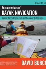
  • - Master the Traditional Skills and the Latest Technologies, Revised Fourth Edition
    av David Burch
    470,-

    For the past 30 years, this book has been the authoritative source for all matters of small-boat navigation. Learn how to find and keep track of your position, adjust to changing conditions, and paddle the seas safely and confidently. Includes how to chart an accurate course and maintain it underwayΓÇöwhether touring locally, on open water, or between islands. This updated text includes everything you need to know, from traditional map and compass navigation through state-of-the-art electronic navigation. Knowledge gained here will enhance the safety and efficiency of any outing.If you are a sea kayaker or long-distance paddler of any craft, this is definitely a book to have and to study. Most kayak instructors nationwide would agree. It covers the principles of navigation that are pertinent to kayaks in clear practical terms, with special emphasis on the effects of wind and current. Piloting techniques are distilled down to those that can be done from the seat of a kayak.The treatment of tides and currents is more thorough in this book than in most others on the market, especially when it comes to reading the water to interpret currents and for estimating the effects of wind on progress to weather. There are also convenient tricks includedΓÇösuch as how to quickly predict the current at times between peak flow and slackΓÇöthat do not appear in other books.The section on the Navigation Rules is a unique treatment of the subject that applies to all self-powered craft, including canoes and paddle boarders, as it addresses the issues and rules that pertain to all vessels, being "every description of watercraft used or capable of being used as a means of transportation on water." This is an important perspective to keep in mind, even for sailors and power boaters, as it brings to the front the basics that underlie the details. Who has right of way in specific circumstances is a detail; evaluating risk of collision is a basic, and so on.Updates in the Revised Edition include reports on progress of the print on demand charts (gets A+); new developments in echarts and how this affects latest nav apps; and updates on technology, including, believe it or not, an actual AIS receiver the size of two 9V batteries that is perfectly usable in a kayak viewing the live traffic signals on an Android app in a phone. There are also many important developments in external battery packs, which are needed when navigating by a phone or tablet. All of the online links in the book are updated, as well as the rest of the references cited. The online support and resources page at starpath.com/kayaknav has been expanded.

  • av David Burch
    400,-

    This book is an updated and expanded edition of a text that has been used in navigation courses for 30 years. It covers practical small-craft navigation (sail, power, or paddle), starting from the basics and ending with all that is needed to navigate safely and efficiently on inland and coastal waters in all weather conditions. It is for beginners, starting from scratch, or for more seasoned mariners who wish to expand their skills. Topics include: Charts, Chart Reading, and Chart Plotting Instruments and Logbook Procedures Compass Use Piloting and Dead Reckoning Lights and Buoyage Tides and Currents Rules of the Road GPS and other Electronic Aids The GPS tells us where we are and how fast we are moving in what direction, but it can never tell us the safest, most efficient route to our destination. That fundamental task requires the basic navigation skills taught in this book, which we can use as well to check the GPS underway, and then be prepared to navigate without the GPS if we need to. The hallmark of good seamanship is to look ahead and be prepared.The text covers not only the long tested traditional methods of navigation but also the efficient use of the latest technology in electronic navigation and charting.

  • - Techniques Exploratoires a l'usage du Marin Curieux et Prudent
    av David Burch
    470,-

    Tous les navigateurs savent que les instruments peuvent tomber en panne. Les choses peuvent se mouiller, se casser ou passer par-dessus bord. Que vous soyez en sécurité sur votre bateau ou dérivant sur un radeau de sauvetage, David Burch vous montre comment trouver votre route quels que soient les instruments de navigation à votre disposition. En s'appuyant souvent sur des objets courants tels qu'un petit bâton, un morceau de doublure ou même une paire de lunettes de soleil, allant des techniques des anciens Polynésiens aux traînées de condensation des avions de ligne, David Burch vous explique comment utiliser tous les moyens disponibles pour calculer vitesse, direction, latitude et longitude ainsi que pratiquer tous les aspects du pilotage et de la navigation à l'estime.

  • av David Burch
    360,-

    The ship's logbook has been a maritime tradition since ancient times. It is used to document the voyages and movement of the vessel and events that take place on board related to safe navigation and the well being of the crew and cargo. Designed for sailors by sailors. The simple layout of these record sheets has been tested over thousands of miles of offshore and coastal sailing, racing and cruising.

  • av David Burch & Larry Brandt
    266,-

  • av David Burch
    356,-

    Practical knowledge for Inland, Coastal, and Ocean waters that makes your sailing safer and more efficient. Special topics in navigation and weather from the "Burch at the Helm" column in Blue Water Sailing magazine.

  • av David Burch
    260,-

    Sextants are used to measure angular heights of celestial bodies above the horizon to find the latitude and longitude of the observer. They can also be used on land with artificial horizons. Sextants can also be used to find the correct Universal Time by measuring the angular distance between the moon and another body along its path across the zodiac. In coastal waters or on land, sextants can be used for very accurate piloting by measuring the horizontal angles between charted landmarks. The vertical angle of a peak above its baseline determines the distance to it, which, combined with a compass bearing, yields a position fix from just one landmark. The angular dip of an object (island or vessel) below the visible horizon can also be used to determine the distance to it. This booklet explains how to get the best results from plastic sextants, and presents numerical comparisons with similar data from metal sextants. Sextant piloting techniques are also reviewed as they are an ideal use of a plastic sextant.

  • av David Burch
    390,-

  • av David Burch
    246,-

  • av David Burch
    340,-

    Helps you become an expert small-craft radar operator. This book enables you to plot a fix from just a single buoy or landmark, and it is the only navigation tool that tells you not just where you are, but who else or what else is out there with you.

  • av David Burch
    250,-

    Shows you how to find your way on the water - even if your navigation equipment is damaged or lost - using ancient and modern skills or rudimentary materials like a stick, a piece of string or a pair of sunglasses. This guide includes navigation methods, graphics and lists. It offers a useful backup for every ocean mariner.

Gör som tusentals andra bokälskare

Prenumerera på vårt nyhetsbrev för att få fantastiska erbjudanden och inspiration för din nästa läsning.