Marknadens största urval
Snabb leverans

Böcker utgivna av Cicerone Press

Filter
Filter
Sortera efterSortera Populära
  • - 10 days trekking in the Bernese Oberland
    av Kev Reynolds
    191

    The Tour of the Jungfrau Region is described as a clockwise circuit of 111km beginning at Schynige Platte and ending at Wilderswil. It is broken into 10 stages (with alternatives offered), through the Bernese Oberland under the Moench, Eiger and Jungfrau. With spectacular mountain views, glaciers, lakes and ridges, it is a classic walk.

  • - The classic Dover/Calais route and the Avenue Verte
    av Mike Wells
    191

    Guidebook to the London to Paris Bike Ride, including both the 500km traditional route, which makes use of cycle tracks and quiet roads plus a ferry crossing from Dover, and the 400km Avenue Verte, a waymarked route via Newhaven/Dieppe which makes greater use of dedicated cycle paths. Each takes 5-7 days and they can be combined for a round trip.

  • Spara 10%
    - 36 walks throughout the national park - coast, Cheviots, Hadrian's Wall and Pennines
    av Vivienne Crow
    181 - 191

    Guidebook to walking in Northumberland. 36 graded walks of 4 to 14 miles, from the beautiful coast with its immense, empty beaches and dramatic, crag-top castles to the remote hills of the Cheviots and Pennines. Includes Hadrian's Wall, Lindisfarne Priory, Kielder, Berwick, Bamburgh and Dunstanburgh Castles and more.

  • - 40 scenic fell, river and woodland walks
    av Dennis Kelsall & Jan Kelsall
    171

    Guidebook to 40 walks, from 3 to 11 miles, exploring the Lune Valley and Howgill Fells, some of the most unspoilt countryside in north west England. Set mainly within the Yorkshire Dales National Park, and the AONBs of Bowland and Arnside and Silverdale, the walking is hugely rewarding, near the centres of Sedbergh, Kendal and Lancaster.

  • - Horcones Valley (Normal) and Vacas Valley (Polish Glacier) ascent routes
    av Jim Ryan
    241

    Guidebook to climbing Aconcagua in Argentina. With descriptions for the Normal route (taking 12 days) or the Vacas Valley route (14 days). The treks cover difficult mountain terrain up to 6962m and are suitable for experienced walkers and mountaineers. Also features other treks in the southern Andes, including the Vallecitos and Tupungato ranges.

  • Spara 10%
    - 40 circular walks in and around the Pembrokeshire Coast National Park
    av Dennis Kelsall & Jan Kelsall
    181

    Guidebook to 40 circular walks in Pembrokeshire in Wales. Routes take in the dramatic beauty of the national park and its coast, the Daugleddau and the Preseli Hills, while exploring wooded gorges, prehistoric hillforts and medieval castles. Walks range from 1 to 12 miles and route descriptions are accompanied by 1:50,000 OS map extracts.

  • - 70 walks, including 21 Munro summits
    av Ronald Turnbull
    211

    A guide to walking and scrambling routes in the beautiful Loch Lomond and the Trossachs National Park. Over 70 graded low-level, mid-level and mountain walks taking in hills, glens and picturesque woodland, as well as all of the region's Munro summits. Highlights include Ben Lui, Ben Lomond, the Cobbler and the Arrochar Alps.

  • - The Isle of Wight Coastal Path and 24 coastal and countryside walks
    av Paul Curtis
    191

    Guidebook to 33 walking routes on the beautiful Isle of Wight, from 4 to 18 miles long. The routes are suitable for all abilities and are accessible all year round. Includes a complete circuit of the island's spectacular coast as well as walks exploring forest trails and downland, and visiting the towns of Yarmouth, Cowes and Ventnor.

  • - 40 routes in the National Park including classic routes
    av Kingsley Jones
    217

    Guide to 40 of the best trail, fell and skyrunning routes in the Lake District, including Helvellyn skyline and Scafell Pike direct. Highlights include recces of Cumbria's best ultra and fell race routes including the Langdale Horseshoe and Borrowdale. Includes info on the history of fell running, races and adapting for the fells.

  • - Schirmeck to Lac Leman, and the GR53
    av Les Smith
    221

    Guidebook to a 687km (427 mile) trek through eastern France, traversing the Vosges and the Haut-Jura plateau. The route follows the GR53 from Wissembourg to Schirmeck, before picking up the central section of the GR5 from Schirmeck to Nyon on Lake Geneva, taking in wooded and grassy hills, river gorges and fascinating castle ruins.

  • - 75 walks in the Maloti-Drakensberg Park
    av Jeff Williams
    257

    This guidebook presents 75 day walks of 1 to 26km in South Africa's Maloti-Drakensberg Park, a UNESCO World Heritage Site. Located in KwaZulu Natal and easily accessible from Johannesburg, Harrismith, Pietermaritzburg and Durban, the region boasts dramatic cliffs, gorges and waterfalls, abundant wildlife and 2000 year old rock paintings.

  • - Eight adventurous trekking routes
    av Radek Kucharski
    301

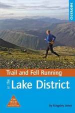
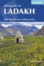
    This trekking guidebook gives detailed descriptions of eight different treks across the Ladakh, Zanskar and Markha Valley in northern India. Ranging from moderate difficulty to very demanding, the treks vary between 6 to 12 days in length, each trek is broken down into multiple stages, and has information on difficulty, available accommodation and access, as well as the many combinations and alternative routes open to exploration. Trek 1: Kharnak, 148 km / 10 days. Starts in Kharu in the Indus Valley and ends in Pang, on the Manali-Leh road. Trek 2: Tsarab Chu, 174km / 12 days. Starts in Pang and ends in Padum, Zanskar. Trek 3: Darcha to Padum - the classic trek to Zanskar, 135km / 9 days. Starts in Darcha and ends in Padum. Trek 4: Round Sultanlango, 112km / 6 days. Starts in Padum and ends in Stongde, Zanskar. Trek 5: Padum to Lamayuru - the classic trek from Zanskar, 148km / 8 days. Starts in Padum and ends in Lamayuru on the Kargil-Leh road. Trek 6: Padum to Lamayuru via the Kanji La, 169km / 10 daysTrek 7: Alchi - a circuit over five passes, 98km / 8 days. Starts in Alchi in the Indus Valley and ends in Phanjila, Wanla, Lamayuru, Nurla or MangyuTrek 8: Markha Valley, 113km / 9 days. Starts in Spituk, southwest of Leh and ends in Hemis near the Indus ValleyKnown as Little Tibet; for both its landscape and culture, Ladakh lies at the northern tip of India. The region is bisected by the great River Indus and neighbours Tibet and Kashmir. This quiet corner of the Himalaya has developed a strong trekking culture over recent years for adventurous trekkers. Trekking in this remote, high-altitude region is extremely challenging, as paths are not signed and there are only a limited number of villages. However, its magnificent landscape (a huge area full of limitless trekking possibilities), hospitable people, rich heritage and limited number of tourists make Ladakh an amazing destination. The guide includes background information on local culture, history and religion, as well as all the planning detail you need on crucial aspects such as environmental responsibility, health and safety in the mountains, trekking practicalities and preparation for altitude.

  • - 30 walks exploring the AONB peninsula in South Wales
    av Andrew Davies
    191 - 211

    This guidebook presents 30 circular day walks in the Gower Area of Outstanding Natural Beauty, taking in the rich variety of landscapes across this beautiful area of South Wales. Ranging from 21/2 to 14 miles long, there are walks to suit all abilities. The peninsula is famous for its spectacularly steep, rugged coastline and perfect golden sand beaches but this guide also takes walkers to the inland valleys, hills and ridges little explored by most holidaymakers. Route descriptions are illustrated with OS mapping extracts and inspiring photography and accompanied by a route summary table to help you choose walks to suit your location and ability. Along the way, the author provides a wealth of information on the plants, animals, geology, history and archaeology of a region with something for everyone, all within a compact area easily accessible from Swansea and Mumbles. Coastal areas such as those around Langland, Oxwich and Port Eynon are well frequented, but this guidebook concentrates on places where walkers can escape the crowds to find peace and solitude in this exceptionally beautiful and unspoilt area.

  • av Jim Rubery
    171

    Guidebook of 30 day walks in Carmarthenshire, south west Wales. Ranging from 2 to 10 miles in length and suitable for walkers of all abilities, the routes introduce the varied walking on offer in this county, including parts of the Brecon Beacons and the Cambrian Mountains. Most are circular, but four are linear walks along sections of the Carmarthenshire Coast Path (CCP). Many of the walks can be reached, either by car or public transport, from Carmarthen, Llandeilo, Llanelli and Llandovery. Alongside detailed route descriptions and clear OS mapping, the book is packed with interesting information about the places and heritage encountered. Notes on landscape, geology and wildlife of the area are included, and for each walk there is useful practical information on transport and refreshments. A county of contrasts with around 1850 miles of footpaths, Carmarthenshire is a walker's paradise. Highlights include the Black Mountains (Mynydd Du), the Teifi Valley, Camarthen Bay, the southwestern Coast, and 'Dylan Thomas Country' around Laugharne.

  • - Northern Spain - Picos to the Mediterranean
    av John Hayes
    257

    This guidebook is for trekkers tackling all or part of the GR1 (Sendero Historico) - 1250km of waymarked route across northern Spain through the Pyrenean foothills from Puerto to Tarna at the western end to near L'Escala on the Mediterranean coast. Broken into 7 sections and 53 stages, the walking goes through remote landscapes, but accommodation is available every day, and the terrain is not difficult. Providing all the information trekkers will need, the guide combines practical information about planning your own itinerary, when to go, what to take and the accommodation, cuisine and terrain with general information about the varied geology and history of the area. Route description is accompanied by contoured mapping and stage and section summary information, as well as detailed information about any accommodation available en route. The GR1 meanders through some of the best scenery northern Spain has to offer while visiting many medieval churches and castles from the time of the Christian kingdoms, the reconquest, the crusades and Spanish Unification as well as key locations in the development of modern Spain. And you'll have long views of the changing landscapes all the way, as the mountains of Spain are not cloaked in trees.

  • - The Corfu Trail and 22 outstanding day-walks
    av Gillian Price
    251

    This guidebook to the Greek island of Corfu describes a selection of 22 superb day walks throughout the island, along with the 150km Corfu Trail. The day walks range from 3.5 to 18km in length, and begin from a number of popular holiday destinations across the island, including Corfu Town (home of the Durrell family), Kalami, Paleokastritsa, Agios Georgios north and south, Liapades and Benitses. The 10-stage Corfu Trail starts near Kavos at the island's southernmost tip and ends at Agios Spiridonas, its northerly promontory. The Corfu Trail is suitable for both novice and experienced walkers, and can be walked year round, however accommodation is easier to find between May to October. The wide range of day walks provides a taste of the many different landscapes of the island from coastal paths and beaches to olive groves and wooded hills. Alongside detailed route descriptions and clear maps, the guidebook has notes on Corfu's plants and wildlife, food and drink, and useful advice on travel to and around the island. It includes suggestions for where to stay, as well as a glossary of useful expressions. Corfu is the greenest of the Greek islands and one of the most accessible; the walks described avoid the crowded resorts and allow you to experience the laidback atmosphere and varied natural landscapes of this beautiful island.

  • - 30 day walks - Saleve, Vallee Verte, Abondance, Bellevaux, Morzine
    av Janette Norton
    191

    First volume of a 2-part guide to walking in the Haute Savoie in the French Alps. This guidebook covers the area south of Lake Geneva to the Swiss border including Saleve, Chablais and the Vallee Verte, with Evian and Morzine among places to stay. 30 walks include local summits and ridges, but generally straightforward terrain.

  • - Howgills, Mallerstang, Swaledale, Wensleydale, Coverdale and Nidderdale
    av Dennis Kelsall
    191

    This guidebook contains 43 circular day walks in the north and east Yorkshire Dales. It explores the dales, hills and moors between Kirkby Stephen and Pateley Bridge. Walking ranges from gentle 3 mile strolls to more strenuous day-long rambles across the Howgills, Wensleydale, Swaledale, Nidderdale, Mallerstang and Coverdale.

  • av Kev Reynolds
    151

    Map of the 130 mile (208km) North Downs Way National Trail, between Farnham and Dover, including an optional visit to Canterbury. This booklet is included with the Cicerone guidebook to the trail and shows the full route on OS 1:25,000 maps. One of the easier National Trails, it can be comfortably walked in 11-12 days.

  • - Over 100 walks, trails and scrambles including Lochnagar
    av Ronald Turnbull
    217

    Guidebook describing a selection of over 100 walks in the Cairngorms National Park and Lochnagar, covering low-level, mid-level and mountain routes (including 18 Munro summits) and both day walks and multi-day treks. From gentle sandy trails to rocky scrambles, the routes suit most abilities, taking in mountains, forests, lochs and moorland.

  • - 32 half and full-day walks in western Spain's hills
    av Gisela Radant Wood
    241

    Guidebook to Extremadura, one of Spain's most unspoilt regions, comprising the provinces of Caceres and Badajoz. 32 mainly circular walks (6 to 19km) explore Sierras, rolling hills and oak forests criss-crossed by thousands of kilometres of ancient paths. Includes the Jerte Valley, the hill town of Montanchez, Guadalupe and Monesterio.

  • - 3 long-distance routes in the AONB: the Suffolk Coast Path, the Stour and Orwell Walk and the Sandlings Walk
    av Laurence Mitchell
    171

    Guidebook to 3 long-distance routes exploring the varied landscapes of the Suffolk Coast and Heaths AONB. The Suffolk Coast Path covers 55 to 60 miles from Lowestoft to Felixstowe. The Stour and Orwell Walk is 40 miles from Felixstowe to Cattawade near Manningtree, while the Sandlings Walk is 59 miles from Ipswich to Southwold.

  • - The tour and 17 day rides
    av Jon Sparks
    237

    The 265 mile (425km) Lancashire Cycleway showcases the idyllic scenery of England's historic Red Rose County. Comprising of two distinct loops that intersect at Whalley in the Ribble Valley, the Northern Loop contrasts the quiet lanes and peaceful countryside of northwestern Lancashire with the thrill of the open moors of the Forest of Bowland AONB; the Southern weaves its way between the villages and towns in the south of the county, an area rich in social history. Easily accessible from the region's rail network, the route - which is all on-road - can be cycled either as a tour or a series of day rides. This guidebook presents the Lancashire Cycleway in 11 stages of 16.5 - 30.9 miles (26.6 - 49.7km), plus two short connections to link the loops to the major regional stations at Lancaster and Wigan, as well as 17 varied day rides for those wishing to explore the county further. Detailed route description and 1:100,000 mapping is presented alongside a wealth of information on local points of interest and facilities, and the magnificent colour photography offers a small taste of what the routes have to offer. The guide also includes useful advice for those new to cycling or cycle touring.

  • - 1:25,000 OS Route Map Booklet
    av Terry Marsh
    166

    The Coast to Coast Map Booklet, a captivating piece penned by the renowned author Terry Marsh, is an exceptional addition to any bookshelf. Published by Cicerone Press in 2023, this book transcends the boundaries of ordinary storytelling. It's not just a book; it's a journey that takes you from one coast to another, immersing you in a unique experience that only Terry Marsh could conceive and execute. The genre of this book, like its content, is refreshingly unique, making it a must-read for anyone who seeks something different from the norm. The Coast to Coast Map Booklet is more than just a book; it's a testament to Terry Marsh's extraordinary storytelling, brought to you by the renowned Cicerone Press.

  • - 40 circular short walks and day walks
    av Kev Reynolds
    191 - 267

    A guidebook describing 40 walks in the county of Kent. Covering west Kent and The Weald and north and east Kent, including the Kent Downs and the Greensand Hills. Walks of 5 to 9 miles explore rivers and coastline, beautiful countryside and historic villages. With outlines of 11 longer walks ranging from 15 to 163 miles.

  • av Andrew McCloy
    163

    This book presents a portrait of the Pennine Way, Britain's oldest and best known long-distance footpath, tracing its remarkable history through the experiences of walkers past and present. As Andrew McCloy walks the 268-mile route from the Derbyshire Peak District to the Scottish borders, he discovers how the Pennine Way set a benchmark for personal challenge and adventure and how reconnecting with wild places and the unhurried rhythm of the long walk continue to provide a much-needed antidote to our busy modern age. The resilience of the long distance walker is mirrored in the path's fascinating history: the initial struggle for access, battles to tame the bogs, later challenges of path erosion and the fluctuating circumstances of the rural hostel. Above all else howeverthis is a book about Pennine Way people - from crusading ramblers to resourceful B&B landladies, hard working rangers to fanatical trail walkers. Their conversations and memories are woven into the narrative to give an account of the changing fortunes of the path and its special significance. Personal, thoughtful and often humorous, The Pennine Way - the Path, the People, the Journey is an exploration of our desire for challenge and adventure, the stimulation of wild places and how a long journey on foot through our own country still resonates today. It will appeal to people who have walked or are preparing to walk the Pennine Way, as well as to those with an interest in the history and legacy of this iconic path.

  • - 32 hill and country walks
    av John Gillham
    187

    Guidebook to 32 walks in the hills of Shropshire. The walks, which are graded easy, moderate or hard, range from 3 miles (5km) to 12 miles (19km) and can be walked in all seasons. The selected routes take in highlights such as The Wrekin, Wenlock Edge, Long Mynd and Stiperstones, Castle Ring and Bury Ditches. Featuring 1:50K OS mapping (shown at 1:40K for greater clarity), step-by-step route descriptions, as well as information on accommodation, getting around, bases for the Shropshire hills and history of the region, the guide details everything you need to walk in Shropshire - and more. From Neolithic standing stones, Bronze Age stone circles, and hilltop forts dating back to the Iron Age, Shropshire offers more than just picturesque landscapes and rewarding walking. Discover history on the hills as well as natural beauty, all within easy driving distance from Birmingham and Manchester.

  • - 1:25,000 OS Route Mapping
    av Paddy Dillon
    237

    Map of the 270 miles (435km) Pennine Way National Trail, between Edale in the Peak District and Kirk Yetholm in the Scottish Borders. This booklet is included with the Cicerone guidebook to the trail, and shows the full route on OS 1:25,000 maps. This popular long-distance route typically takes three weeks to complete.

  • - From Edale to Kirk Yetholm
    av Paddy Dillon
    257

    Guidebook to the Pennine Way National Trail with OS map booklet. The 270 mile route from Edale to Kirk Yetholm takes three weeks to walk and is suitable for fit and experienced long distance walkers. The route crosses the Peak District, Yorkshire Dales and North Pennines National Parks. Includes separate OS 1:25,000 map booklet of the route.

  • - Julian Alps - Gorenjska and Soca Valley, South, Central and North East
    av Rob Houghton
    241

    Guidebook to 35 full-day and half-day mountain biking routes in Slovenia. The routes, which are graded, range from 12 to 59km, taking in Gorenjska, Soca Valley, the South, as well as Central and North East Slovenia. Includes a Slovenian glossary plus all you need to know about getting there, getting about, bikes, equipment and accommodation.

Gör som tusentals andra bokälskare

Prenumerera på vårt nyhetsbrev för att få fantastiska erbjudanden och inspiration för din nästa läsning.