Marknadens största urval
Snabb leverans

Böcker utgivna av Cicerone Press

Filter
Filter
Sortera efterSortera Populära
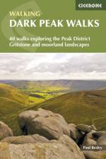
  • - 40 walks exploring the Peak District gritstone and moorland landscapes
    av Paul Besley
    191

    Guidebook to 40 walks in the Dark Peak area of the Peak District National Park. 35 circular routes for most abilities, from 8km to 19km, around Edale, Marsden, Fairholmes, Baslow and Castleton, including Kinder Scout and Mam Tor, and 5 longer (25km to 45km) routes highlighting the best of the Gritstone Edges, High Moorland and Deep Valleys.

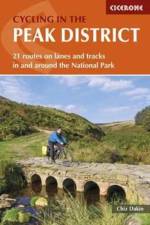
  • - 21 routes on lanes and tracks in and around the National Park
    av Chiz Dakin
    191

    Guide to cycling in and around the Peak District National Park, on road or trail bike. 20 day routes and one multi-day cycle tour of the Peak District. All easily accessible from Sheffield and Manchester with routes starting from charming Derbyshire towns such as Ashbourne, Matlock, Bakewell and Buxton. Includes route profiles and 1:100000 mapping.

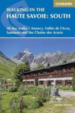
  • - 30 day walks - Annecy, Vallee de l'Arve, Samoens and the Chaine des Aravis
    av Janette Norton
    257

    Second volume of a 2-part guide to walking in the Haute Savoie in the French Alps. This guidebook describes 30 half to full-day routes in the area between Chamonix and Annecy. Walks are located near Samoens, Sixt, La Clusaz, Thones, la Roche-sur-Foron and Lake Annecy. Includes Chaine des Aravis, Plateau de la Borne and Haut Giffre.

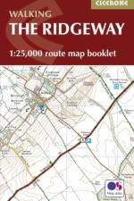
  • - 1:25,000 OS Route Mapping
    av Steve Davison
    121

    Map of the 87 mile (139km) Ridgeway National Trail through the south of England from Avebury in Wiltshire to Ivinghoe Beacon in Buckinghamshire. This booklet is included with the Cicerone guidebook to the trail, and shows the full route on Ordnance Survey 1:25,000 maps. Presented in 12 stages in the guidebook, the trail typically takes 6-8 days.

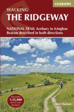
  • - Avebury to Ivinghoe Beacon, described in both directions
    av Steve Davison
    257

    This guidebook - which includes both a guide to the route and a separate OS map booklet - describes the Ridgeway National Trail, an 87 mile (139km) route through southern England from Avebury in Wiltshire to Ivinghoe Beacon in Buckinghamshire. Typically walked in 6 or 8 days, this is a low-level waymarked route suitable for all abilities and for year round walking. The guidebook details the trail in both directions, west to east and east to west. Step-by-step route descriptions are accompanied by 1:100,000 OS mapping and a separate OS 1:25,000 map booklet showing the entire route is included. Packed with details on points of interest and a trek planner giving at-a-glance information about facilities, public transport and accommodation available along the way, this book is an indispensable guide to walking this national trail. Following a ridge of chalk hills through the Chiltern Hills AONB and North Wessex Downs AONB, the Ridgeway takes walkers through five counties and five thousand years of history. It offers a scenic and fascinating journey through our ancient and more recent past, visiting the UNESCO World Heritage Site of Avebury's Neolithic stone circle and the famous Uffington White Horse, and includes excursions to picturesque villages, thatched cottages and cosy pubs.

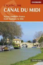
  • - Across southern France from Toulouse to Sete
    av Declan Lyons
    211

    A guide to cycle touring along the Canal du Midi in the sunny Languedoc region of southern France. The 240km main canal route, and the 37km Narbonne extension are described. Information is also given on short detours to sights close to the canal, and longer excursions into the surrounding countryside. Those planning a week-long cycling holiday should concentrate of the main canal and some of the short detours. Reasonably fit cyclists should be able to complete the canal and the excursions in two weeks. A stage-planning table is also included to make it easy to work out a different schedule to suit a particular timescale and ability. For each stage a route description with sketch map in included, together with details of terrain, availability of shade, ascent or descent made, maps needed, historical points of interest and information about places passed en route.

  • - 30 walks in Edinburgh's local hills
    av Susan Falconer
    171

    This guidebook describes 30 circular walks in Scotland's Pentland Hills, a range of low summits which extends between Edinburgh and Biggar in South Lanarkshire. Ranging from 3 to 27km (2-17 miles), there is something to suit all abilities from the novice to the experienced hill-walker, with each route showcasing a different aspect of the area's unique character. Step-by-step route description is accompanied by 1:50,000 OS mapping and a wealth of interesting information on the region's rich natural and cultural heritage: its geology, history, wildlife and connections with literary greats such as Robert Louis Stevenson and Sir Walter Scott. Local place names are explained, local folklore explored and there is a helpful glossary of dialect terms. The Pentland Hills can be enjoyed in all seasons. Although the highest summit, Scald Law, stands at 579m, stunning vistas belie their modest elevation: this is a region of grass and heather-clad slopes which rise above picturesque valleys hiding streams and reservoirs. Walking in the Pentland Hills is an ideal companion to discovering great walking on Scotland's most accessible hills.

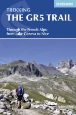
  • - Through the French Alps from Lake Geneva to Nice
    av Paddy Dillon
    251

    An essential guidebook for walking the GR5 trail, 660km from Lac Leman (Lake Geneva) to Nice or Menton, through the French Alps. Includes all the main variant routes as it passes Mont Blanc, then through the Vanoise, the Queyras and the Mercantour National Parks. Includes accommodation, profiles and maps. Suitable for fairly experienced hikers.

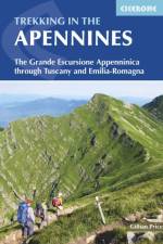
  • - The Grande Escursione Appenninica
    av Gillian Price
    191

    Guidebook to the Grand Apennines Trek, or Grande Escursione Appenninica (GEA). Through Tuscany and Emilia-Romagna and 2 national parks, this 400km trail takes 23 days to complete, exploring the mountains, forests and hills of central Italy. Suitable for a range of walkers, it can be split into shorter sections or day walks if needed.

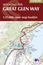
  • - 1:25,000 OS Route Mapping
     
    147

    Map of the 79 mile (124km) Great Glen Way (one of Scotland's Great Trails), between Fort William and Inverness. This booklet is included with the Cicerone guidebook to the trail, and shows the full route on Ordnance Survey 1:25,000 maps. The route typically takes a week to walk, and is suitable for walkers at all levels of experience.

  • - 1:25,000 OS Route Mapping
     
    166

    Map of the 177 mile (283km) Offa's Dyke Path National Trail, between Sedbury (near Chepstow) and Prestatyn. The trail takes 2 weeks to walk, and is suitable for walkers at all levels of experience. This compact booklet of OS 1:25,000 maps shows the full route, providing all of the mapping you need, and is included with the guidebook.

  • - National Trail following the English-Welsh Border
    av Mike Dunn
    257

    This guidebook - which includes both a guide to the route and a separate OS map booklet - describes Offa's Dyke Path National Trail from south to north, following the longest linear earthwork in Britain, running 177 miles along the English-Welsh border between Sedbury (near Chepstow) and Prestatyn on the north Wales Coast. The book splits one of Britain's classic trails into 12 stages suitable for walkers of all abilities. Step-by-step route descriptions are accompanied by 1:100,000 OS map extracts. Also included with this guidebook is a booklet of 1:25,000 OS maps, which provides all the mapping needed to complete the trail in a compact form. A trek planner gives at a glance information about facilities, public transport and accommodation available along the route. The walk is astonishingly varied, taking in the lower Wye gorge, the Severn and the Dee rift valley, the pastures and woodlands of the border country, the remote moorland of the Black Mountains and the Clwydian range, and the dramatic limestone escarpments of Eglwyseg mountain. What makes it even more special is over 60 miles walking alongside the Saxon earthwork of Offa's Dyke.

  • av Phoebe Smith
    191

    An introduction to some of the best bothies in the UK. Featuring 26 selected bothies, the author shares her memories of using these free 'stone tents' in some of the country's wildest and most remote locations. Alongside notes on legends and landscape, wildlife and history, the book is full of expert guidance and tips on how to make use of bothies, from packing lists to bothy etiquette and the best walking routes in. Inspiring and fun, the book showcases bothies in Snowdonia, the Brecon Beacons, Lake District, Pennines, the Highlands and Islands of Scotland, and Northumberland, and is a personal celebration of the world of bothying. Hidden away in the hills and mountains of England, Scotland and Wales - for years known only to a lucky few - is a network of huts, cottages and shelters. Completely free to use, these secretive refuges can be life-savers, quick stops and destinations in themselves. The network of British bothies is cared for by the Mountain Bothies Association, and day-to-day by the walkers, climbers and mountain lovers who rest there.

  • - 19 Long-Distance Routes through England, Scotland and Wales
    av Paddy Dillon
    277

    Inspirational guidebook to Britain's National Trails - 19 long-distance walking routes through England, Wales and Scotland. Together, these routes (National Trails in England and Wales and Scotland's Great Trails) cover well over 3100 miles (5000km), exploring the rich scenic and historic countryside of Britain. This larger-format guide explores the full breadth of the network, including the popular South West Coast Path, Hadrian's Wall Path, West Highland Way, Cotswold Way, Offa's Dyke Path, South Downs Way, Southern Upland Way and many others exploring the beauty and wild country of the British Isles. Outline schedules for each Trail allow you compare the routes and become inspired to take up the challenge, whether on a relatively short or easy trail, or to tackle a longer, more strenuous route. Basic day-by-day route descriptions for each Trail are illustrated with maps and profiles. Information is provided on access to and from the routes, maps, public transport, guidebooks, TICs, accommodation and useful websites.

  • - Graded routes on cycle-friendly roads in Cornwall, Devon, Somerset and Avon and Dorset
    av Colin Dennis
    181

    This guidebook explores 20 sportive cycling routes in the best cycling areas of south west England. Ideal for training, the rides range between 59 and 119km (36 to 74 miles) in length, and offer a full range of challenges; from long, fast flat routes, perfect for pacing, to tough hill climbs on the Downs and Moors of the south west. The 20 sportive routes are found in Cornwall, Devon, Dorset, Somerset, Wiltshire and Gloucestershire, as far north and east as the Wye Valley and Swindon. The range ensures that there is plenty of riding to be found, throughout the region, not to mention the companion Sportives guidebook to routes in England's south east. From the Cotswolds, to Dartmoor, Exmoor, Bodmin Moor, into Wales and the south coast, there are miles of of cycle-friendly roads suitable for sportive training. All 20 routes are graded for difficulty and include timings, ascent, food-stops and access information, as well as annotated route maps and clear route descriptions. Sportive cycling is a growing sport, and this guide provides routes for experienced riders and those new to this sport. Useful information on bike maintenance and equipment, to travelling around the areas with your bike and advice on accommodation is also included. The result is a sportive guidebook that will prepare you for the challenges ahead, and allow you to explore the best cycling the south-west has to offer.

  • - Graded routes on cycle-friendly roads between Kent, Oxford and the New Forest
    av Colin Dennis
    181

    This guidebook offers 20 sportive routes in the most challenging and scenic cycling areas of south east England. From the Surrey and Chiltern Hills to the New Forest and Berkshire Downs, the area boasts miles of cycle-friendly roads suitable for sportive training. The graded routes are all on quiet country roads and can be mixed and matched.

  • - From the source to the Rhine at Koblenz
    av Mike Wells
    211

    This guidebook provides 14 stages of route description to cycling along the Moselle river, a route that offers stunning scenery, plentiful accommodation and places to eat and drink, and straightforward cycling throughout. A well-waymarked, generally downhill 512km route, it is mostly off-road and on well-surfaced cycle tracks (mainly asphalt) with virtually no gradients, and the majority is along the riverbank or on canal towpaths. From its source in the Vosges Mountains of eastern France, the Moselle flows through the French region of Lorraine and crosses into Luxembourg then into the German Rheinland region before it reaches its confluence with the Rhine at the west German city of Koblenz. Suitable for both veteran long-distance cyclists and for newcomers to cycle touring who wish to start with an easy-to-follow journey, the route can be completed in a week by fit cyclists, cycling two stages per day. Two weeks allow for alternative stages and optional excursions through the Saar and Rhine gorges and to visit the Boucles de Moselle and the city of Luxembourg, and give enough time for sightseeing and a leisurely riding pace.

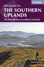
  • - 44 best hill days in southern Scotland
    av Ronald Turnbull
    191

    This guidebook describes 44 routes and over 100 summits across the Southern Uplands of Scotland, stretching south-west from Edinburgh to the English border, including the Galloway and Pentland Hills. The walks range between 2 and 29km, suitable for walkers of all abilities. The Scottish Southern Uplands is a range that is about as big as the English Pennines. It is wild hill country, with over 80 hills of 2000ft or more, and it boasts a real remoteness that is difficult to find elsewhere. All hillwalkers should experience these wonderfully characterful landscapes: green and gentle, but with hidden surprises and remote escapes. The routes are suitable from spring to autumn, and on winter days with good weather and snow conditions. Each route provides OS mapping, information on distance, ascent, time, maximum altitude and terrain, as well as details of any variants or shortcuts. With notes on points of interest along the way as well as on transport and accommodation, the guide gives all the information walkers need.

  • - Tales of Trekking in Nepal
    av Kev Reynolds
    277

    On eight treks in Nepal's Himalaya; to Kanchenjunga, Manaslu, Annapurna, Everest, Langtang, Dolpo, Api and Mugu, the true spirit of trekking is captured in Kev Reynolds' reverence, curiosity and ongoing love of the world's greatest mountain range. The Himalaya are no ordinary mountains. Stretching through five countries and dwarfing all others, they have captured the imaginations of travellers and mountain lovers for centuries. While some seek to reach their snowy heights, many more step out onto winding and climbing trails to trek through the heart of the mountains, and live - if only for a little while - the life of an adventurer. The first time a trail is explored offers unknown beauty and fresh experience around every turn. This is Kev Reynolds' collection of eight such discoveries along popular trails and into lands previously locked away. Brought to life in vivid style, Reynolds evokes the scent of fragrant rhododendron jungles and travelling past terraced fields, hillside villages and ancient temples. Then exploring into hidden valleys beyond the reach of civilization, and on to towering, ice-locked peaks that scratch the sky. All proceeds from sales of this book will be donated to the Nepal Earthquake Appeal.

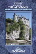
  • - Belgium, Luxembourg and the Ardennes
    av Jeff Williams
    217

    Walking in the Ardennes covers 32 day walks between 2 and 24km and one multi-stage route, the Sentier du Nord. The Ardennes region in southern Belgium overlaps into Luxembourg and France and features rolling hills, deep valleys, rivers and wide reaches of forest. Walks take in WW2 battlefields, medieval castles, towns and villages.

  • av Peter Edwards
    191

    This guidebook covers 20 mountain biking routes set throughout the length and breadth of the North Downs, from Farnham in the west to Dover in the east, as well as a route along the Downs Link, which joins the North Downs Way with the South Downs Way. They range from 18.5km to 59km in length and up to 90% off road. The routes, illustrated with OS map extracts and height profiles, are graded for difficulty (blue, red and black) and are suitable for mountain bikers with at least some experience and a reasonable degree of fitness. The guide gives practical information on recommended gear, preparation and safety, as well as details of accommodation and local bike shops.

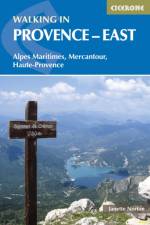
  • - Alpes Maritimes, Alpes de Haute-Provence, Mercantour
    av Janette Norton
    217

    Guidebook to 30 varied day walks in the east of Provence in the Alpes Maritimes, Alpes de Haute-Provence and Mercantour, with practical information for the walker. Walks span from the Esterel on the coast to the Mercantour, and include the Verdon Gorge and Geological Reserve of Haute Provence, from bases such as Vence, Grasse and Digne-les-Bains.

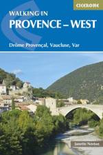
  • - Drome Provencal, Vaucluse, Var
    av Janette Norton
    217

    Guidebook to 30 varied day walks in the west of Provence in the Drome Provencale, the Vaucluse and the Var, with practical information for the walker. Walks span from the Baronnies in the north to the Ste-Baume ridge in the south and can be tackled from charming bases such as Nyons, Apt and Aix-en-Provence.

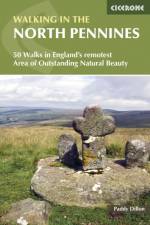
  • - 50 Walks in England's remotest Area of Outstanding Natural Beauty
    av Paddy Dillon
    181

    A guidebook to day walks in the North Pennines Area of Outstanding Natural Beauty (AONB), across Cumbria, County Durham and Northumberland. The book includes 50 walks exploring England's 'last wilderness', ranging from 5 miles (8km) to 14 miles (23km). Most are circular, though there are some linear routes, and there is something to suit all abilities over a variety of terrain. Route descriptions are illustrated with OS mapping and colour photographs, and the book includes details of local transport services, accommodation and tourist information centres. The walks cover a variety of terrain, from flat railway trackbeds to pathless moorland, and provide the opportunity to explore the striking geological features and fascinating industrial heritage of the area.

  • av Peter Edwards
    221

    This guidebook describes 21 mountain biking routes in central and southern Scotland. It includes the 7stanes trail centre in Dumfries and Galloway, as well as cross-country routes in the Campsie Fells, Pentland Hills and Lammermuirs, the Galloway Forest, Tweed Valley, Cheviots and Lowther Hills. The routes range from 17 to 66km and are graded from moderate to very hard. Taking between 2 and 7 hours to complete, they are intended for reasonably fit mountain bikers with at least some experience. Detailed route descriptions are accompanied by 1:50,000 OS mapping, and the selected routes set out from various points across the area, including Greenock, Glentrool, Peebles and Milngavie, with good access from both Glasgow and Edinburgh. The guidebook also gives an overview of what the region's MTB trail centres have to offer, including the famous 7stanes trail centre, along with advice on equipment, maintenance and safety.Southern and Central Scotland is renowned for its superlative MTB trail centres, but the region's rolling hill country is also traversed by an extensive network of tracks, paths, forest roads and other trails providing endless possibilities for 'free range' mountain biking.

  • av Sean Benz
    257

    This guidebook to mountain biking routes in North and North West Scotland describes 25 MTB routes north of the Great Glen, Covering a large geographical area, including Fort William, Rannoch Moor, Glen Spean, Ben Nevis, Sutherland, Torridon and Skye, the routes give a real flavour of the variety of different bike riding available. The routes range from 19.5km to 73.25km, graded moderate to very hard. Many are long and committing, so good preparation and fitness are essential, and in some cases a willingness to "e;hike and bike"e;. Each route has a clear and detailed route description along with 1:50,000 OS mapping and a height profile. All routes have key information, including distance on and off-road, ascent, grade, time and the nearest pub and cafe. There is also advice on equipment, planning and preparation, and maintenance, before you hit the trails. Scotland is rightly regarded as one of the world's top mountain bike destinations, with magnificent riding and stunning scenery. From the self-proclaimed Outdoor Capital of the UK, Fort William, to the majesty of the Outdoor Hebrides, this guide you will access some of the wildest and remote parts of Scotland, offering scintillating single track, challenging descents, incredible mountain vistas and many rewarding days in the saddle.

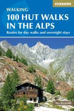
  • - Routes for day walks and overnight stays in France, Switzerland, Italy, Austria and Slovenia
    av Kev Reynolds
    217

    This popular guidebook by expert Kev Reynolds describes 100 walks focusing on the mountain huts of the Alps. With walks in France, Switzerland, Italy, Austria and Slovenia, there are routes to suit every taste - from gentle and undemanding to long and tough, as well as all varieties of difficulty in between. What they have in common is a visit to a hut, each with its own character. Some walks are perfect for lunch at a hut before a return to the valley base, others involve an overnight stay at a hut. In a few cases, a short hut-to-hut tour is suggested. The routes are grouped by country and by specific Alpine district. Most of the routes avoid any climbing of a technical nature, beyond the odd scramble aided by a fixed rope. Notes on hut etiquette, what to take and an English-French-German-Italian glossary are also included to help trekkers get the most out of their time in the Alps.

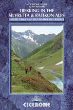
  • - Tour of the Silvretta, the Prattigauer Hohenweg and the Ratikon Hohenweg plus 12 day routes
    av Kev Reynolds
    241

    This guidebook describes 3 Alpine treks, between 5 and 8 days long, as well as 12 full or half day hut-to-hut routes. The three treks suitable for moderately experienced trekkers, but requiring no specialist equipment, are the Tour of the Silvretta, the Prattigauer Hohenweg and the Ratikon Hohenweg, two of which can be combined to provide a fortnight of high-altitude hiking among such peaks as Piz Buin, Piz Linard, Dreilanderspitz, Schesaplana, Sulzfluh and Drusenfluh and over some classic Alpine passes. The Silvretta and Ratikon ranges straddle the borders of Switzerland, Austria and Liechtenstein. Also included are descriptions of nearby climable peaks for those with excess energy and favourable conditions, and for those who prefer to plan their own tours a directory of all the mountain huts in the area, providing all the information you could possibly need. Written by Alpine expert Kev Reynolds, this book includes tips on gear, planning, language and further reading, to fully enjoy your time in the Alps.

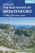
  • - A Walker's and Trekker's Guide
    av Rudolf Abraham
    221

    This guidebook to Montenegro includes day-walks and multi-day treks throughout the Dinaric Alps, ranging from 1 hour to 5 days, with a selection of circular and linear routes, with variants and extensions. The 17 walks and trekking routes take in Montenegro's five national parks as well as other areas including Orjen, Komovi, Tara Canyon and the UNESCO-listed old town of Kotor. Walks are all graded, from easy outings to challenging treks involving exposure and scrambling. Many of the multi-day routes will require camping or staying in unstaffed mountain shelters. With a range of practical information on maps, language, travel to and around the country, and accommodation, this is a comprehensive and informative guide for walkers who wish to sample one of the finest walking destinations in Europe. These mountains are some of the wildest, most spectacular, and least visited in Europe. Nevertheless they are easily accessible, and many areas have well-marked trails. They present an opportunity to travel through outstandingly beautiful and remarkably unspoilt natural scenery, which sees few visitors.

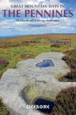
  • - 50 classic hillwalking routes
    av Terry Marsh
    271

    An inspirational guidebook to 50 great walks throughout the Pennines. A wide range of routes in this larger format book have been selected to help walkers explore all aspects of this beautiful upland area. The walks are all graded, from moderate to strenuous, and are between 6 and 13 miles long, with plenty of options for both first-time and more experienced walkers. Ranging between the North Pennines, Howgills, Yorkshire Dales, South Pennines and Dark Peak, this guide offers the best of the mass of fell and moor that makes up the backbone of England. Routes include Cross Fell, Wild Boar Fell, Ingleborough, Whernside, Pen-y-Ghent, Pendle Hill, Kinder Downfall and a traverse of Ilkley Moor and many are suitable for fell running. The circular walks are all graded, making this guidebook equally suitable for first-time and more experienced walkers looking to explore new corners of the Pennines. All routes are illustrated with 1:40,000 OS mapping and plenty of colour photography.

Gör som tusentals andra bokälskare

Prenumerera på vårt nyhetsbrev för att få fantastiska erbjudanden och inspiration för din nästa läsning.