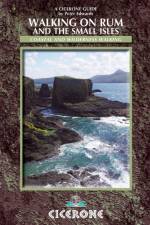
- Rum, Eigg, Muck, Canna, Coll and Tiree
av Peter Edwards
217 - 247
This guidebook describes 16 routes across Rum, Eigg, Muck, Canna, Coll and Tiree, suitable for a wide range of abilities, and exploring coast, mountains and wilderness. The 15 day walks include a challenging round of the Rum Cuillin, and the one 3-day 55km backpacking route heads around the Rum coastline, sometimes over pathless and tough terrain. Each route provides OS 1:50,000 mapping, information on distance, ascent, time and terrain, as well as details of any variants or shortcuts. The Small Isles are often called the hidden gems of the Western Isles, providing a walking paradise for those seeking wilderness and solitude, alongside the better-known Rum. Highlights include, on Rum, the towering volcanic peaks of the Rum Cuillin, Kinloch Castle, Kilmory bay; An Sgurr and Cleadale on Eigg; Canna's towering cliffs and rock stacks; the verdant landscape and sparkling shores of Muck; and the white sand bays and flower-carpeted machair of Coll and Tiree. Each island is different and has its own introduction here, with detailed information on geology, history and wildlife, as well as local amenities.