Marknadens största urval
Snabb leverans

Böcker utgivna av Cicerone Press

Filter
Filter
Sortera efterSortera Populära
  • av Julia Goodfellow-Smith
    147

    Discover 15 of the best short walks in the Malvern Hills, including Worcestershire Beacon. Each walk comes with easy-to-read Ordnance Survey maps, clear route description and lots of images, plus information on beauty spots and refreshment stops. No challenging terrain or complicated navigation means walks can be enjoyed by everyone.

  • av Mark Richards
    147

    15 of the best short walks around Hadrian's Wall for you to explore. Our guidebook comes with easy-to-read Ordnance Survey maps and clear route descriptions, perfect if you're new to walking or are looking for something you can enjoy with the whole family. Most walks are under 3 hours in duration and from 2-7 miles (4km to 11km) Easy-to-read Ordnance Survey maps, clear route descriptions and lots of images Includes Birdoswald, Sycamore Gap, Housesteads, Vindolanda and Sewingshields Crags Most routes are accessible by public transport GPX files available for download

  • - 40 of the best small mountains in Scotland under 3000ft
    av Kirstie Shirra
    217

    A walking guidebook to 40 of the best small mountains in Scotland under 3000ft, with OS maps and routes described as day-walks with ascents accessible to non-climbers. The guidebook splits Scotland into seven areas - Sutherland and the far north, Torridon, Lochaber, the Great Glen, the Cairngorms, Glencoe, Arrochar, the Trossachs and the islands (Skye, Eigg, Mull, Arran). With routes that range in length and difficulty and alternative options given there is something for walkers of all abilities. The guide also includes background information on the mountains and places of interest, practical advice on each route and how to prepare and make the most out of these small mountains and information on history, geology, flora and fauna. The popularity of Munro-bagging - climbing all the mountains in Scotland over 3000ft - has left many of Scotland's finest mountains overlooked by walkers. What they lack in stature, they often more than make up for in beauty, views and character. This book champions just some of Scotland's best smaller mountains - from the surreal and striking landscape of The Storr in Skye, the pagan festivals of Ben Ledi in the Trossachs to the imposing and rugged ridges of Quinag in the Sutherland.

  • av Hendrik Morkel
    257

  • av Andrew Beattie
    257

    This guidebook describes 38 walking routes in Ticino, the Swiss canton with a Mediterranean twist. Towering snowcapped mountains and lush, narrow valleys overlook stylish lakeside resorts with palm-fringed promenades and handsome Italianate architecture. It's not just the Italian language that sets Ticino apart: the food, sunny weather and stunning landscapes attract millions of visitors to this part of the southern Alps every year. As for the walks, it's the variety - as much as the fabulous scenery - that provides the draw. In this book you'll find everything from level walks along the shores of Lakes Lugano and Maggiore, to more challenging trails through craggy, forested valleys with gushing waterfalls and ancient stone-built villages, to isolated mountain huts right at the permanent snowline. If you think you already know Switzerland, but haven't walked in Ticino, a stunning experience awaits you - and all of the routes are easily accessible through a network of buses, trains, funiculars, cable cars and chairlifts.

  • av Nike Werstroh
    147

    15 of the best short walks around Guildford, Dorking and south Surrey. No complicated navigation or challenging terrain means these walks can be enjoyed by everyone. Most walks are under 3 hours in duration and from 3-8 miles (5km to 13km) Easy-to-read Ordnance Survey maps, clear route descriptions and lots of images Includes Box Hill, Leith Hill, Devil's Punch Bowl and Reigate Fort, plus walks near Guildford, Dorking and Farnham Most routes are accessible by public transport GPX files available for download

  • av Jonathan Williams
    147

    15 of the best short walks in the Lake District around Windermere, Ambleside and Grasmere. No challenging terrain or complicated navigation means walks can be enjoyed by everyone. Most walks are under 3 hours in duration and from 3-7 miles (5km to 11km) Easy-to-read Ordnance Survey maps, clear route descriptions and lots of images Includes Loughrigg, Elterwater, Orrest Head, Hill Top, Wray Castle, Dove Cottage and the Lion and the Lamb All routes are accessible by public transport GPX files available for download

  • - 30 day walks exploring the islands
    av Richard Barrett
    217

    This guidebook describes 30 day walks all over the Isles of Harris and Lewis, in the Outer Hebrides. The walks range from 2 and 14 miles (4 to 22km) in length, and are easily accessible from Stornaway or Tarbet. Routes vary from short strolls to long wilderness hikes, high-level and low-level, and include the An Cliseam horseshoe, visits to ancient historic monuments like the stone circles of Calanais and the famous Butt of Lewis lighthouse, all illustrated with OS 1:50,000 maps and dramatic photography. The routes take in most of the main summits as well as historical and geographical places of interest. A list of all the Marilyns (British hills of any height with a drop of at least 150m on all sides) on Harris, Lewis and St Kilda is included at the back. Tips are also included about walking on St Kilda, Berneray, Taransay, The Shiant Islands and The Flannan Isles, along with a short Gaelic glossary and route summary table, and advice on practicalities to make the most out of any walking trip on Harris and Lewis.

  • av The Reverend Sandy Brown
    261

    A guidebook to walking or cycling the California Missions Trail. The 802 mile (1291km) pilgrimage route from Sonoma to San Diego links 21 Christian missions founded by the Spanish over 200 years ago. It can be enjoyed by walkers of all abilities, or alternatively, 95% of the route is also suitable for road bikes. The Missions Trail is described in 20 stages of between 16 and 60 miles (26-97km), with alternative options for cyclists. It can be walked in 50-60 days or cycled in 12-20 days. GPX files available to download 1:100,000 mapping plus larger-scale town maps for key locations Handy route summary tables and pilgrim lodging listings help you plan your itinerary Detailed information about refreshments and facilities along the route Advice on planning and preparation The history of the missions, as well as the story of the Native Americans who originally shaped the landscape

  • av Nike Werstroh & Jacint Mig
    251

  • - From the Alps to the Mediterranean
    av Mike Wells
    257

    Guide to The River Rhone Cycle Route, an 895km bicycle ride starting high in the Alps of central Switzerland and finishing at the Mediterranean Sea, near Marseille. The route - which is mostly downhill - is divided into 20 stages (averaging 45km per stage) and can be completed by most cyclists in 12-14 days. The described route uses two waymarked national cycle trails: the Swiss R1 Rhone Route and the French ViaRhona, which together have been adopted by the ECF (European Cyclists' Federation) as EuroVelo route EV17. The guide provides detailed route descriptions and 1:150,000 mapping for each stage, together with plenty of practical advice such as preparing for the journey, transport options there and back, what to take, accommodation en route and more. A Swiss/French glossary is also included. Taking in dramatic mountain vistas, Lake Geneva's enchanting beauty and the coastal delights of southern France, the route showcases some of the region's most spectacular scenery, making it a veritable gem for any tour cyclist looking to stretch their legs in stunning surrounds. If a visual feast is not enough, cyclists can indulge in the gastronomic wonders of the region. And need we mention the fact that the Rhone flows through some of the greatest wine producing regions of both Switzerland and France?

  • av Paddy Dillon
    211

    Guidebook offering detailed descriptions of 40 day walks, plus 10 traffic-free cycle routes along old railway trackbeds. Together they cover 450 miles and spread all over County Durham to show the region's history and natural wonders. The terrain covered ranges from field paths to open moorlands, from the North Sea to the high Pennines.

  • - Snowdon, Glyders, Carneddau, Eifionydd and outlying areas
    av Steve Ashton
    221

    Guidebook to 80 graded scrambles in Snowdonia, North Wales. This revised edition of Steve Ashton's classic guide is illustrated with photo topos, and includes 16 routes selected by the updaters, as well as all the classic routes including the Snowdon Horseshoe, North Ridge of Tryfan, Bristly Ridge and the Cneifion and Cyfrwy Aretes.

  • - The best low level walks and challenging mountain routes
    av Paddy Dillon
    217

    The 45 walking routes in this Isle of Arran guidebook range from easy 3km (2 miles) nature trails to long arduous mountain routes with scrambles (up to 32km) providing thorough coverage of Arran, including the ascent of Goatfell and nearby Holy Isle. Most routes are 10 to 15km long but many give opportunities to create longer cross-island walks.

  • av Iain Harper
    217

    Day walks and 2 short multi-day routes in and around Knoydart in the western Highlands, one of Britain's last true wilderness regions. Covering the Rough Bounds, Morvern, Moidart, Ardgour and Ardnamurchan, the guide features a selection of mountain and coastal routes. Includes ascents of several Munros and Corbetts.

  • av Mike Wells
    217

    Guidebook to cycling the Loire, France's longest river, from its source in the Massif Central to the Atlantic. The 1061km route incorporates the popular, waymarked Loire a Velo and takes in extinct volcanos, vineyards and chateaux. Predominantly downhill or flat, the route utilises mostly cycle paths and minor roads.

  • av Iain Harper
    251

    This guidebook describes the Cape Wrath Trail, a long-distance trek from Fort William to Cape Wrath crossing the wild northwest of the Scottish Highlands. The route is described from south to north in 14 stages, with 6 alternative stages along the way, allowing for a flexible itinerary of between two and three weeks. A long tough trek with no waymarking, this is for the tried and tested backpacker. The guidebook includes OS mapping, route profiles and detailed route descriptions and gives you all the information you need about accommodation (including hotels, bothies, B&Bs and bunkhouses), campsites and amenities en route, to help you plan and prepare for this epic challenge. The Cape Wrath Trail is regarded as the toughest long-distance route in Britain and offers unparalleled freedom and adventure to the experienced and self-sufficient backpacker prepared to walk for many days in remote wilderness. Travelling through the wild and rugged landscapes of Morar, Knoydart, Torridon and Assynt, it will test the limits of your endurance.

  • av Peter Edwards
    321

    Stunning backpacking routes in the Scottish Highlands and Islands are covered in this inspiring, large-format guidebook. 30 routes are described, ranging from 1-4 days, with most suitable for a long weekend. The routes are divided between the Western Highlands and Inner Hebrides, the Central and Eastern Highlands, the Northwest Highlands, the Far North and the Outer Hebrides. They are suitable for those with the experience and self-reliance to navigate proficiently and stay safe in an environment which can easily become inhospitable. Although some routes visit bothies, most call for at least one night's wild camping. Each walk includes overview data, route description and 1:100,000 mapping and they are illustrated with stunning photos. An introduction offers background information about the Highlands' rich geology, plants and wildlife and the historical and cultural context of Scotland's 'wilderness'. There is also practical information on preparing for an incursion and advice for those looking to expand their experience of wild-country backpacking. The Highlands and Islands of Scotland are home to the most ruggedly beautiful, expansive and challenging backpacking country in the British Isles. This is a land for those who love open spaces, vast horizons, and the domination of nature.

  • av Steve Kew
    211

    This guidebook is volume 2 of a two-part set, detailing 70 routes to 144 Munros in the Cairngorms and Northern Highlands (north of the Great Glen). It includes all the popular routes, in areas such as Knoydart, Torridon and on Skye. The guide is ideal for Munro bagging, or for guidance on walking such hills as Ben Macdui, Cairn Gorm, The Angel's Peak, Craig Meagaidh and the Cuillin on Skye. All routes prefaced by a wealth of information about Gaelic names, accommodation and access; useful 10-figure grid refererences for key points such as summits and start point of awkward descent lines; travel and other information on making the most of your walks and your stay in the area. As well as a thorough introduction covering, transport and accommodation, each route includes information on distance, ascent, and route time; as well as detailed descriptions of the walk. Volume 1 covers the Munros of the southern, central and western Scottish highlands.

  • av Giles Belbin
    227

    Abounding in history and dotted with cols coloured by stories about the world's greatest cyclists, the Route des Grandes Alpes (RdGA) is a must for competent, hill-hungry cycle tourers. Covering some 720km from Lake Geneva (Lac Leman) to mediterranean Nice, the route is described across 14 stages and can be completed in anywhere from 7 to 14 days - depending on how you'd like to spread out the 17,000m of climbing. Six variants are also described, ensuring no holiday is compromised or cut short if a col on route is closed. Clear and concise route descriptions are provided for each stage (and variant), together with 1:150K mapping and extremely helpful gradient profiles. Also included is invaluable practical adviseeverything from bicycle selection (including eBikes) and nutrition in the saddle, to logistical planning and accommodation options. Showcasing some of the world's best Alpine cycling, the RdGA takes in 17 major climbs, including the famous Col de l'Iseran (the highest paved pass in the Alps), the Col du Galibier (favourite climb of Tour de France founder, Henri Desgrange) and the Col d'Izoard (synonymous with cycling legends Fausto Coppi and Louison Bobet). It also passes through some of the most spectacular national parks in France, including the Vanoise, the crins and the Mercantour.

  • av Paddy Dillon
    240,99

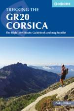
    This guidebook describes the classic GR20 trek, a north-to-south traverse of the rugged mountains of Corsica, renowned as Europe's toughest GR long-distance route. Described in 16 stages, some with high and low-level alternatives, the route is roughly 190km in length and takes approximately two weeks to complete. The GR20 climbs high into the mountains. It is a demanding trek suitable only for experienced walkers, and there are several steep 'hands-on-rock' sections calling for a sure foot and a good head for heights. It is possible to stay under a roof every night but many trekkers opt to camp. Step-by-step descriptions of each stage are accompanied by 1:50,000 mapping, together with information on ascent/descent, terrain and the availability of food, water and accommodation/shelter. There is also invaluable practical information such as path conditions, what to take, and getting to/from and around Corsica. Overviews of the history and geology of the island and local plants and wildlife are offered to enhance the trekking experience. Finally, a separate map booklet, included with the guide, provides all the 1:25,000 IGN mapping needed to complete the GR20. Starting in Corsica's northwest, in picturesque Calinzana, the route winds southeast through the heart of the island, finishing on the eastern side, just north of Porto Vecchio in the township of Conca. It showcases Corsica's rich diversity of landscapes and ethereal beauty. Bare rock and sheer cliffs contrast with black sand beaches, alpine pastures, maquis and pockets of forest. There are also opportunities to detour from the route to visit traditional mountain towns and villages for a taste of Corsica's vibrant history and culture and to take in neighbouring summits, including the island's highest peak, Monte Cinto. For those up to the challenge of hiking part or all of the route, the GR20 promises adventure, memorable experiences and rich rewards.

  • av Andy Davies
    211

    Guidebook to 45 graded circular walks in the Brecon Beacons National Park, perfect for those wishing to discover the diversity of the region, away from the crowds. The routes range from 4 to 24km and cover the north-eastern, eastern and south-western valleys and ridges, Fforest Fawr, Waterfall Country, the Black Mountain (Mynydd Du) and the Black Mountains (y Mynyddoedd Duon). Designed to include all the interesting facts an expert park ranger would provide, the guide contains a wealth of information about local geology, botany, archaeology, history, mythology, industrial heritage and environmental issues. Clear route description is illustrated with 1:50,000 OS Landranger mapping, summary statistics are provided for each walk and handy tables make it easy to compare routes or choose according to points of interest. A useful Welsh-English glossary is also included to help you make sense of local place-names. A remarkably varied landscape, the Brecon Beacons National Park showcases some of the best scenery in Wales. The walks take in mountain peaks and ridges, waterfalls, wooded river gorges and remote upland valleys, with highlights including Pen y Fan, the highest peak in south Wales, and the spectacular Sgwd Gwladus (White Lady Falls), Sgwd yr Eira and Sgwd Clun-gwyn waterfalls. Picturesque market towns on the edges of the park, such as Llandovery, Brecon, Crickhowell and Abergavenny, are also great places to explore and ideal bases for a walking holiday.

  • av Paddy Dillon
    257

    The Wales Coast Path offers an unparalleled opportunity to walk a nation's coastline in its entirety. Stretching 1400km (870 miles) from Chester to Chepstow, including Anglesey, the waymarked trail takes 2-3 months to complete but can easily be broken into shorter sections. The walking is generally not difficult, although there are occasional rugged sections, steep ascents and descents and more remote stretches with fewer facilities. Promising fantastic scenery and a unique insight into local history and culture, what better way to experience the diversity and beauty of Wales' captivating coastline?The route is presented in 57 stages, ranging from 16 to 32km, each featuring clear route description illustrated with 1:100,000 mapping, overview statistics and notes on the availability of accommodation, facilities and public transport links. You'll find plenty of helpful advice for planning your walk, plus background information on Welsh history, geology, plants, wildlife and local points of interest. A facilities table, Welsh glossary and useful contacts can be found in the appendices. Passing through the Snowdonia and Pembrokeshire Coast National Parks, as well as numerous AONBs and sections of Heritage Coast, the Wales Coast Path takes in seaside resorts, attractive fishing villages, sandy beaches, rocky coves and striking cliff coastline. Highlights include the picturesque Llyn and Gower peninsulas, 13th-century 'Iron Ring' castles and frequent opportunities for wildlife spotting. The route can be linked with Offa's Dyke Path National Trail (covered in a separate Cicerone guide) to complete a full circuit of Wales.

  • av Steve Davison
    181

    Guidebook to 30 circular day walks in the North Wessex Downs Area of Outstanding Natural Beauty (AONB). The routes, which range from 4 to 13 miles long take in parts of four counties - Berkshire, Hampshire, Wiltshire and Oxfordshire. The walks allow you to explore parts of the Ridgeway National Trail, the Kennet and Avon Canal and stunning historic sites, such as Avebury, the 3000-year-old Uffington White Horse, impressive Neolithic long barrows and Iron Age hill forts. The North Wessex Downs are accessible hills that rise above the towns and rural plains of southern England and roll gently west from Reading and Basingstoke to Swindon and down past Marlborough to Andover. Alongside detailed route descriptions and OS maps, are plenty of details on points of interest, as well as practical information on the area from public transport links, to ideal refreshment stops on each walk. The result is an ideal companion to exploring both the popular and untouched corners of the North Wessex Downs.

  • av Vivienne Crow
    277

    King of the Fells. Iron man. Lake District fell running legend. Joss Naylor is all of these things and more. His achievements are astounding, his records stand the test of time. In 1983 he completed the 105-mile Lakes, Meres and Waters (LMW) route in a staggering 19hr 14min and to this day, describes it as one of the best routes he ever ran. High praise indeed and yet, so few know of it. Part guidebook, part inspirational regaling, this book interweaves tales of past and present as Naylor reflects on his 1983 epic on a re-walk 37 years later. In the company of award-winning author, Vivienne Crow, Naylor recalls that magical day, sharing stories and anecdotes from, not just his run, but the 1980s fell running scene, his working life and growing up in the Wasdale Valley. Naylor's tales, together with breathtaking photography, are accompanied by basic guide notes for the LMW route, sticking as closely to his 1983 run as possible. These notes divide the route into ten stages (ranging from 9 to 14 miles), allowing runners and walkers to follow in the footsteps of the King of the Fells, albeit on a more relaxed schedule. From Loweswater to Over Water, visiting 27 of the Lake District's largest bodies of water, the LMW route guarantees vistas of unparalleled beauty and an unforgettable experience in true fell country.

  • Spara 10%
    - 24 Routes and the Jersey Coastal Walk
    av Paddy Dillon
    181

    Guidebook describing 24 day walks on Jersey in the Channel Isles. Parts of many routes can be combined to make longer routes, including the 48 mile Jersey Coastal Walk and part of the Channel Islands Way. Walks are between 3 and 8 miles, mainly on good paths and tracks, although occasionally rugged cliff paths explore the beautiful coastline.

  • av Steve Kew
    211

    This guidebook presents 69 challenging and inspiring routes to climb 139 Munro mountains, including Scotland's highest peak, Ben Nevis. Part of a two-part set, this first volume covers the southern, central and western Highlands (south of the Great Glen), taking in stunning areas such as Glen Coe, Glen Shee, Lochaber and Mull. Covering popular and lesser-known routes, it is ideal both for Munro-baggers and those who simply love great mountain walking, and is a convenient size for slipping in a rucksack. The half-day and full-day walks and scrambles range from 7km to 48km (with the option to reduce walking distance on some of the longer routes by cycling the approach). Detailed route description and 1:100,000 mapping is accompanied by information on difficulty, mapping, parking, access and nearby accommodation. The guide also includes handy lists of Munros, by height and alphabetically - perfect for peak-baggers - as well as useful details on Gaelic names. Including the iconic Ben Nevis, Buachaille Etive Mr and Aonach Eagach ridge as well as the Mamores, Grey Corries and Arrochar Alps, Walking the Munros volume 1 is an ideal companion to conquering the Munros and discovering the magnificent mountain landscapes of the southern Highlands. Volume 2 details the other 143 Munros, covering the northern Highlands, Cairngorms and Isle of Skye.

  • av Paul Besley
    171

    This guidebook is the ideal companion for walkers who want to explore the western section of Derbyshire's White Peak area. Starting in towns and villages including Castleton, Ilam, Buxton, Tideswell, Hartington and Longnor, these day walks are perfectly suited for year-round trips to the Peak District and are suitable for walkers of all abilities. Across 40 day walks, this guidebook offers a range of routes that showcase the best of the Peak District landscape: rolling green hills rising up to limestone ridges, deep dales with meandering rivers, and limestone caves and pinnacles. There is plenty of history to explore too, with many walks visiting historical sites from Neolithic, medieval and industrial periods. Most of the walks range between 4 and 9 miles and can be enjoyed in 2-4 hours walking. As several start from the same car park or village, many walks can be combined for longer days out. Each walk features clear OS mapping and detailed route description interspersed with insights into the area's history, geology, art and culture, making this a brilliant guide for both navigation and learning about the Peak District.

  • av Terry Marsh
    121

    Map of the 79 mile (127km) Dales Way through the Yorkshire Dales between Ilkley and Bowness-on-Windermere. This booklet is included with the Cicerone guidebook and shows the full route on OS 1:25,000 maps. One of the most gentle multi-day walks in Britain, it passes through Grassington, Kettlewell, Dent, Sedbergh and Staveley.

  • av Ronald Turnbull
    191

    The south-eastern Grampians of the former county of Perthshire may be grassier and less rugged than other Scottish mountains, but they are just as big. The routes in this guide take you to the summits of these 'jolly green giants' - covering all of the region's Munros, often by unconventional routes, as well as several Corbetts and smaller hills - and also over the Atholl passes, along rivers and through the woods of Perthshire's 'Big Tree Country'. The 80 walks comprise a mixture of low-level, mid-level and mountain routes and are graded by both length and difficulty. Many are demanding, crossing remote, uneven, steep and/or pathless terrain, but also included are gentler walks on clear paths taking in local features of interest. The route description is illustrated with clear mapping (a mixture of OS 1:50,000 and smaller-scale maps for the longer routes) and the route summary table and grading information make it easy to choose an appropriate route. There is a wealth of information about the landscape and the region's fascinating history. Finally, appendices cover local facilities and access to the hills during the deer-stalking season. With highlights including the mighty Ben Lawers, Beinn Dorain, Ben Alder and Beinn a' Ghlo; Schiehallion; the great rivers Tay and Garry; the Birks of Aberfeldy; and old drovers' routes over the passes of Minigaig and Gaick, Perthshire has plenty to offer. And with historic towns, such as Perth and Pitlochry, and attractive villages, this is an ideal base for a walking holiday.

Gör som tusentals andra bokälskare

Prenumerera på vårt nyhetsbrev för att få fantastiska erbjudanden och inspiration för din nästa läsning.